• Published on

    Allalinhorn - 4,027m - An "Easy" First 4,000er

    Overall rating: ★★★★★

    Difficulty: ★★★★☆- Physically not too difficult, provided you're acclimatised. Difficulty mainly comes from glaciated terrain and the skills necessary to navigate this safely. (Alpine grade F+.)


    Start point: Mittelallalin

    Distance: 6km

    Elevation: 600m

    Time: Approx. 4 hours

    Gear needed: Full alpine gear - ice axe, crampons, helmet, rope

    Need to know: Saying an easy 4,000m peak is a bit misleading - it's not easy compared to your average mountain walk but it's easy up against the likes of the Matterhorn in the 4,000m class.

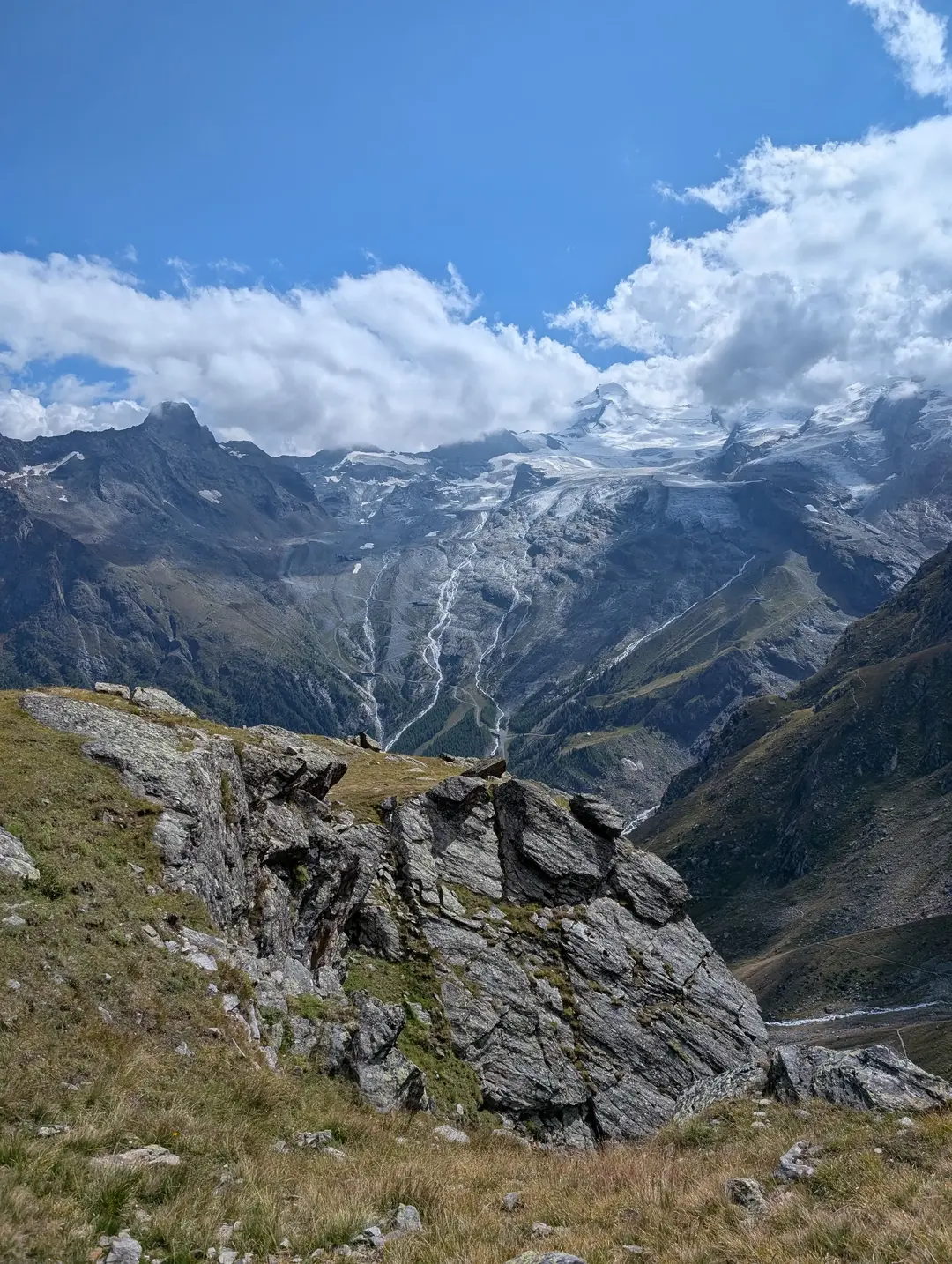
    The Allalinhorn isn’t exactly a famous name outside of climbing circles – I hadn’t heard of it before booking a trip to Saas Fee. It doesn’t have the looks of the Matterhorn or the legendary status of Mont Blanc, but what it does have is a reputation as one of the more “friendly” 4,000m peaks in the Alps. The Alps have over eighty of these so-called “4,000ers” and, while most require long treks to refuges, tricky ridges or a painfully early alarm clock, the Allalinhorn is a little more forgiving for us mortals. Thanks to Saas Fee’s lift infrastructure, two separate cable cars followed by the MetroAlpin (the highest underground funicular in the world), you can be standing on a glacier with crampons and an ice axe in hand within an hour. All this infrastructure makes it feel almost like cheating, but we weren’t complaining.
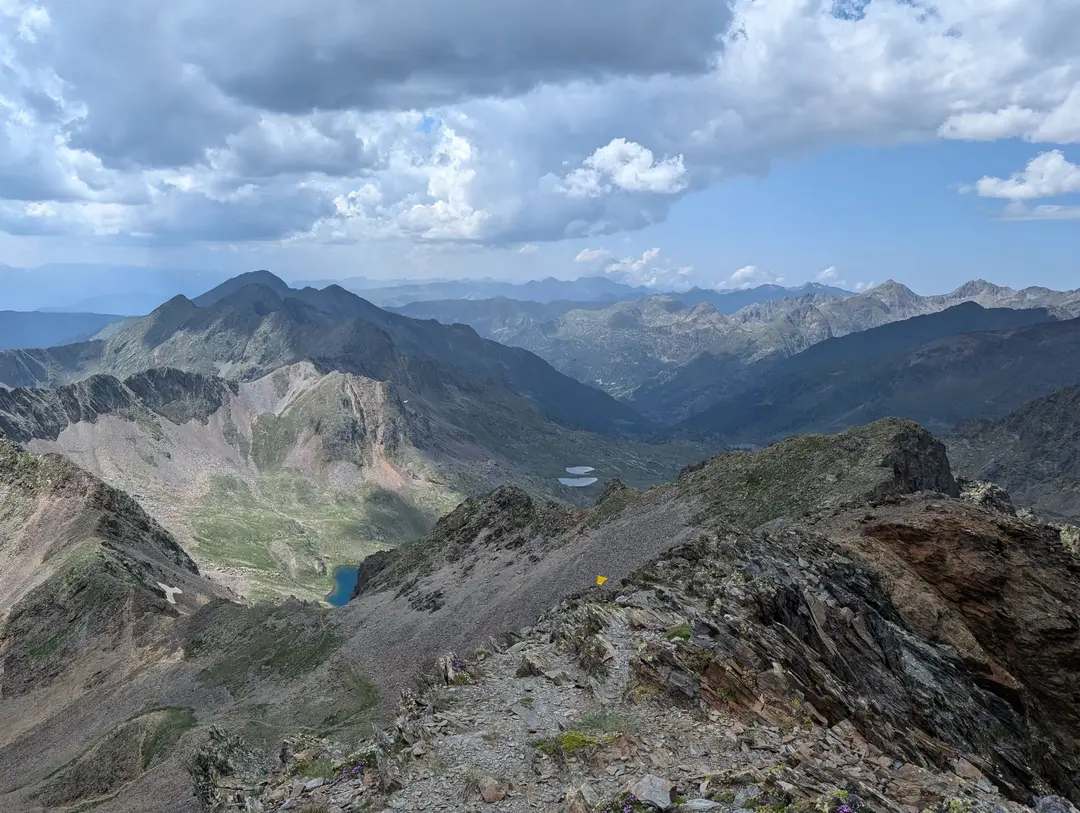
    View of Allalinhorn seen from above Saas Fee.
  • Published on

    Climbing Europe's Most Active Volcano in Winter Conditions - Mount Etna

    Overall rating: ★★★★☆

    Difficulty: ★★☆☆☆- Fairly easy if you follow the main trail, think the final ascent could push this up to a 3 depending on conditions (if the volcano lets you summit)


    Start point: Rifugio Sapienza

    Distance: 15km

    Elevation: 1000m (not quite all the way to the top)

    Time: Approx. 6 hours - including a long stop at the top cable car station

    Gear needed: Standard hiking gear, boots are helpful to keep ash out of your shoes. Crampons needed in winter if attempting summit.

    Need to know: Etna is Europe's (and one of the world's) most active volcanoes and is almost constantly erupting in one form or another. There are restrictions on how high you can go without a guide, and though these are seemingly easily bypassed, it would be wise to take these into account for your own safety.

    ​Rising from the Mediterranean, Mount Etna stands as the highest volcano in Europe, the highest mountain in southern Italy and one of the world’s most active volcanoes. What better idea then, than to try to climb it (I am told sarcasm doesn’t translate well in writing). 

    Mount Etna peaking out from beneath the clouds
  • Published on

    Comapedrosa - 2,943m - Andorra's Highest Mountain

    Overall rating: ★★★★★

    Difficulty: ★★★☆☆ - Scree and a bit of scrambling on the ridge. A full day out


    ​Start point: Arinsal

    Distance: 14km

    Elevation: 1,340m

    Time: Approx. 9 hours

    Gear needed: standard hiking gear

    Need to know: Thunderstorms are common in the afternoons

    Whilst the Alps get most of the attention in the European mountain scene, there’s an equally beautiful and dramatic range on the other side of France. The Pyrenees form the natural border between France and Spain, stretching from the Mediterranean in the east to the Atlantic in the west. Nestled amongst these jagged peaks is Andorra, an ancient and tiny landlocked country that often gets forgotten about. If it does come up in conversation, it’s usually for the tax-free shopping or the skiing.

    View of Pyrenees from Comapedrosa summit ridge
  • Published on

    Casamanya - 2,740m - Andorra's Friendly Hill-Shaped Mountain

    Overall rating: ★★★★☆

    Difficulty: ★★☆☆☆ - No scrambling, easy route to follow, not too long


    Start point: Coll d'Ordino

    Distance: 7km

    Elevation: 740m

    Time: Approx. 4 hours

    Gear needed: Standard hiking gear

    Need to know: Watch out for the poisonous flowers

    Nestled in the heart of Andorra, a mountainous European microstate, Casamanya stands as an unassuming "hill looking" mountain. At 2,740m, it would tower over any peak in the UK, but here it appears as a friendly grass-covered hill amongst the country's highest peaks.


    This is frequently quoted as one of Andorra's most popular mountains, but on this beautiful July afternoon, we were blessed to have the peak to ourselves.

    Casamanya from the end of the woods
  • Published on

    Pico del Teide - 3,718m - Sunrise from Spain's Highest Mountain

    Overall rating: ★★★★★

    Difficulty: ★★★☆☆ - No technical difficulty but steep at times (I wasn't the most fit when we climbed this, which might have skewed my rating - Ros didn't struggle)


    Start point: Sendero de Montana Blanca

    Distance: 9.5km (one way)

    Elevation: 1,350m

    Time: Approx. 5 hours

    Gear Needed: Standard hiking gear

    Restrictions: Permit needed

    Pico del Teide, or Teide for short, rises magnificently out of the Atlantic Ocean on the island of Tenerife. At 3,718m, it is probably one of the highest peaks in Europe that can be climbed with no real technical difficulty. It also happens to be the highest mountain in Spain (though subject to debate). On our second trip to the Canary Islands, an excuse to get some winter sun, we decided to get up super early to try to beat the sun to the summit.

    View of Teide from a hike to Masca