- Published on
Comapedrosa (2,943m) - Route Guide & GPX | Andorra's Highest Mountain
- Author
-
-
- Name
- Posts
- Posts
-
Last updated: April 2026
Whilst the Alps get most of the attention in the European mountain scene, there’s an equally beautiful and dramatic range on the other side of France. The Pyrenees form the natural border between France and Spain, stretching from the Mediterranean in the east to the Atlantic in the west. Nestled amongst these jagged peaks is Andorra, an ancient and tiny landlocked country that often gets forgotten about. If it does come up in conversation, it’s usually for the tax-free shopping or skiing.
Part of the reason for Andorra’s relative anonymity is that it isn’t the easiest place to reach. Despite being close to the UK as the crow flies, there’s no airport or train line into the country, and the surrounding mountains mean the nearest airports are still a fair drive away. We made the beautiful three-hour journey from Barcelona a few days before, and whilst it requires a bit of extra effort, the reward is stunning summer scenery without the crowds of Europe’s more famous hiking spots.
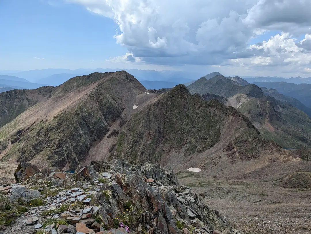
The Pyrenees from Comapedrosa's summit ridge
Andorra’s mountains are varied, ranging from the hill-like Casamanya to peaks that feel properly alpine. Comapedrosa, the country’s highest, is very much one of the latter. Having warmed up on Casamanya the day before, we knew this would be more of a challenge – but we came with the intention of climbing the highest point, and we’d be damned if we didn’t give it a shot.
Comapedrosa Route Guide
Overall rating: ★★★★★
Difficulty: ★★★☆☆ - Scree and a bit of scrambling on the ridge. A full day out
Start point: Arinsal
Distance: 14km
Elevation: 1,340m
Time: Approx. 9 hours
Gear needed: Standard hiking gear
Need to know: Thunderstorms are common in the afternoons
The Ascent
Our day started in Arinsal, a ski resort in the winter and a sleepy mountain village in the summer. With temperatures set to be in the mid-twenties, it would have probably been wise to set out early. Of course, we ended up starting at around 10 am, which was certainly less than ideal. However, we had a plan - we had read rumours that the cable car from Arinsal runs up to around the level of the refuge (more on this later). This would roughly halve the elevation for the day to make it a bit easier, given I was recovering from a bit of a stomach bug. A couple of minutes' drive down the road, and we saw the cable cars moving through the station, hopes were high that maybe the rumours were true. By the time we had parked the car and run to the station, they had stopped though, looks like they were just doing some maintenance. We got back in the car and drove a few more minutes up the road to the official start point – we would be climbing the whole mountain.
Finding the start of the route would be the next challenge, turns out that whilst the trail itself is fairly well marked, finding the start is less easy when you’re not 100% sure where you’re going. We ended up turning off the road one trail entrance too early and spent half an hour meandering through the woods to a pool in the river. Whilst beautiful, we realised we were on the wrong trail and had to back-track after speaking to some friendly locals. We are usually not this useless, I swear.
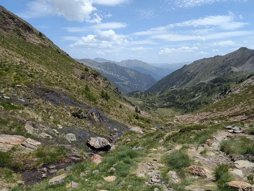
Before long, we managed to find the actual trail and began to make our way steadily up through the tree-lined valley floor, crossing over the small river a few times and following the red and white markers. By this time, our morning mishaps meant we were now walking through the humid wooded section in the hottest part of the day. I think it’s safe to say that spirits were not too high at this point, as we were suffering for our slow start and questioning what we had gotten ourselves into.
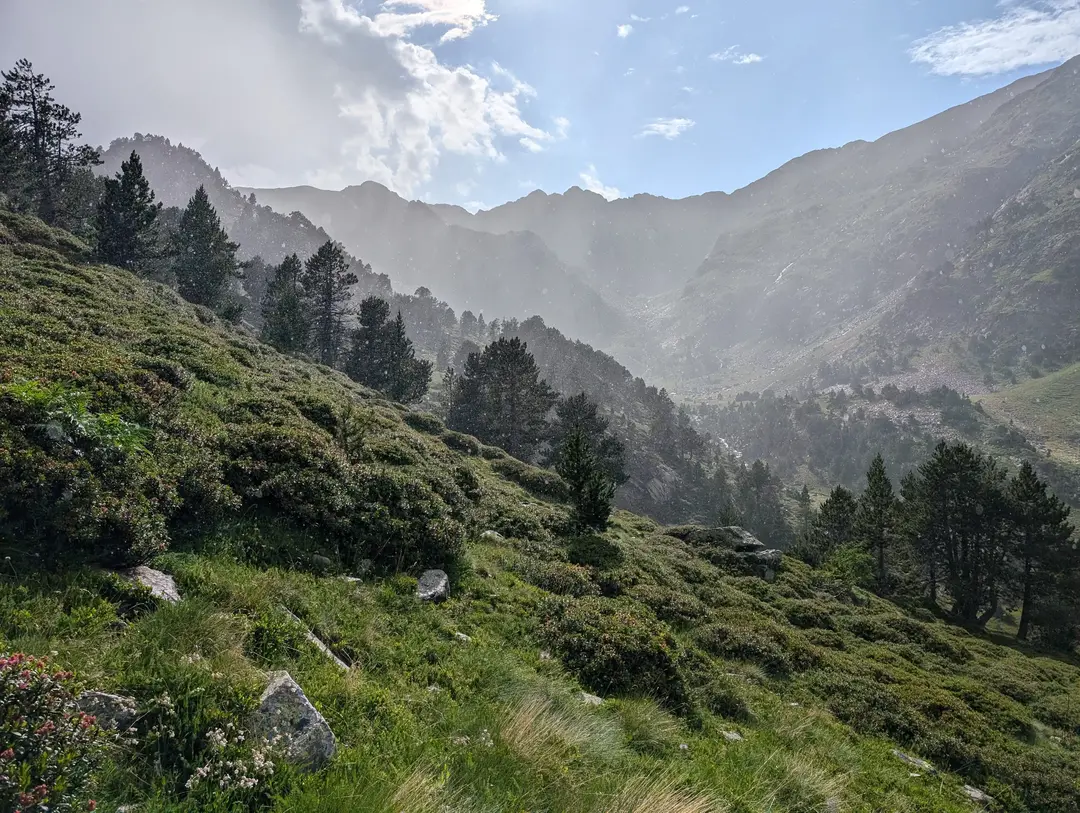
First glimpse of Comapedrosa above the thinning trees, or is it?
Thankfully, the trees soon began to thin out, revealing views through the valley and releasing some of the humidity. The sound of a helicopter would follow us for the next hour or so as it made repeated trips to the refuge to drop off supplies of bottled water, canned drinks and food. The sound of its engine getting closer would be a motivating way-marker for me in knowing we were getting closer to our first proper break. This initial climb through the woods felt unrelenting, with the path taking a direct route and a near-constant incline all the way.
Towards the top of the valley climb, the path crosses back over the river. Lower down the river is quite rapid in places, with sturdy bridges to cross the cascading water. Up here, it was more of a stream, so it was a case of a quick walk through the babbling water. The path then climbed steeply up the other side and into the higher hanging valley. At this point, you either continue straight through the hanging valley or turn left up to the refuge. We decided on the latter and spent a good half an hour enjoying a cold Aquarius (a delicious electrolyte drink that we can only seem to find in Spain/Andorra) and soaking in the views. A dog at the refuge, whose owner was nowhere to be seen, had taken a bit of a liking to us and decided to bark at anyone who approached. After getting some odd looks from people who thought we had no control over our dog, we thought it best to get a move on. Spirits were much higher after the refuge, strongly recommend the little detour.
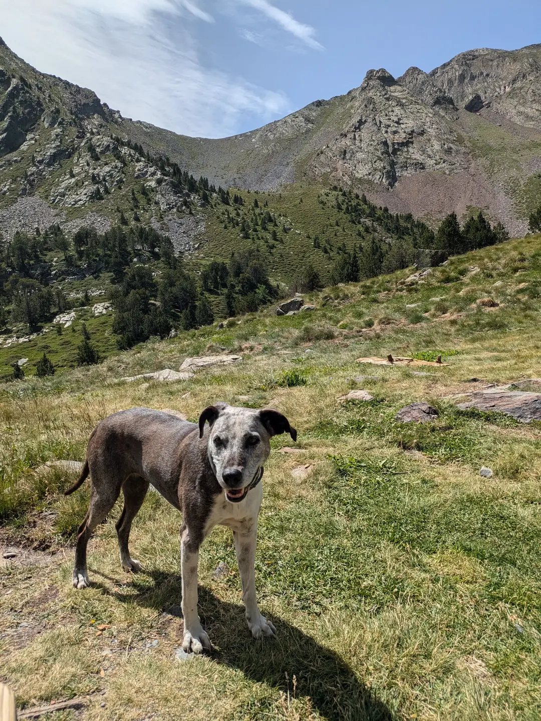
Our 4-legged friend at the refuge
The path continues up through a beautiful hanging valley, which was almost flat and offered a much-needed rest for the quads before starting up the ascent again toward the head of the valley. Here, the scree slopes and cliff faces above are the French border – it is exactly what you would imagine a natural border to look like and seems almost completely impenetrable. Thankfully, our plans for the day did not include scaling the border into France, and the route turned off to the right and up past a small alpine lake (Estany de Comapedrosa) and on to a couple of permanent snow patches. It is always an odd feeling seeing snow when the temperature is in the mid-20s (that’s Celsius for any Americans). I imagine this is not going to be a sight that will last very long in the Pyrenees, with even the glaciers on the higher peaks seeing record levels of melt in recent years.
The hanging valley with the refuge back in the distance
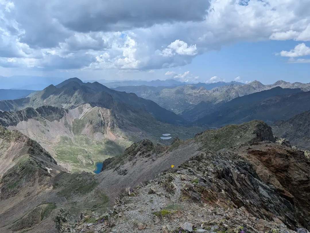
The route then soon reaches a bigger lake – Estany Negre, which didn’t appear black at all but rather a crystal-clear blue under the July sky. Just before this, there is a turn off which heads steeply up the ridge towards the summit. However, we had read that this required quite a lot of scrambling (spoiler – it’s not that bad) and so were put off and decided to continue around the lake. This would turn out to be a mistake. Though the lake is beautiful, the route that you end up following is almost entirely on scree. We initially headed up towards a col, which again is the French border, but the path turned right sharply and headed steeply uphill directly to the summit. This last steep stretch was extremely unstable underfoot, and though not exposed, it is definitely not the best route to the summit. We wasted a fair amount of time traipsing our way up the scree. The consolation, though, was that the views at this point were stunning, with peaks out across the whole Pyrenees poking up out from behind the neighbouring peaks – you can just make out Aneto, the highest mountain in the Pyrenees, on a clear day. It was also at this point that we started to notice dark clouds forming.
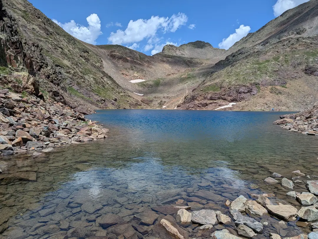
Crystal clear alpine lake with the route ahead visible
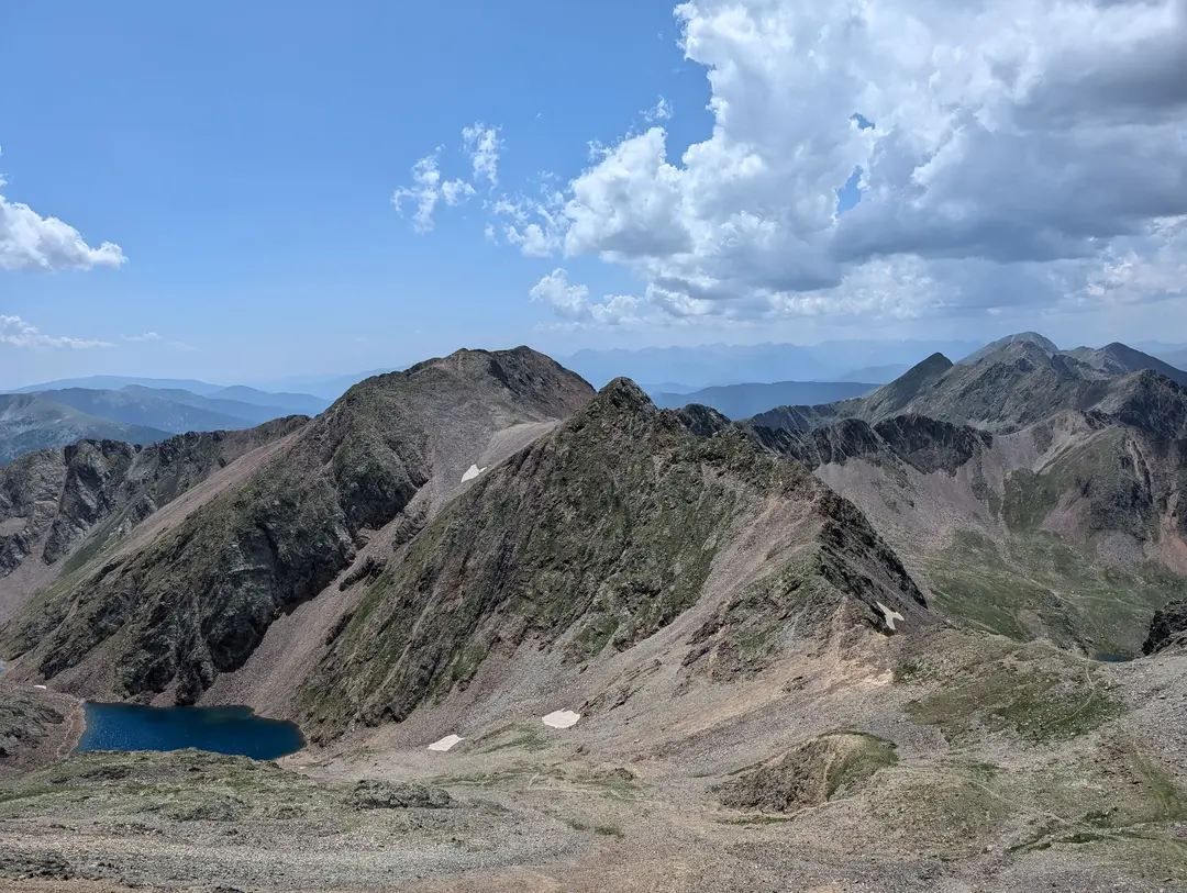
Taking a break to admire the view towards the end of the scree section
By the time we reached the summit, there were definite moody-looking clouds above us. We enjoyed the summit to ourselves for a few quiet minutes before making a move down from the high ground. Our initial plan was to eat our sandwiches on the summit, as is practically the law; however, we thought it best to hold off. The Pyrenees are prone to late-afternoon thunderstorms – given our late start, we were concerned about hanging around on high ground for too long. Not keen on slipping our way down the scree we had just tackled, though, we decided to follow the ridge down on the descent instead. This would turn out to be a much better option and, though hands were used a couple of times, the scrambling was minimal. More importantly, there was next to no scree. The ridge is certainly more exposed than the ascent we took, but it never feels particularly precarious and offers great views out over the whole of Andorra, including Casamanya, which we climbed the day before.
As we were coming off the ridge and descending back down towards the permanent snow patches, we could see rain off in the distance and heard a crack of thunder. Though we were no longer on the summit, we were still uncomfortably high up. It was now a mission to get off the high ground as soon as possible.
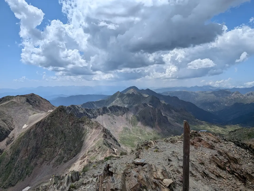
A moody but beautiful summit view
We reached the small lake and were greeted by the rain front hitting us. After a few tense moments waiting for a thunderstorm to break out, we realised that we had gotten lucky.
The storm we had feared never materialised, and we were instead treated to some light rain. This was honestly quite refreshing after the humid and sticky ascent of the early afternoon. Once we had descended a bit further, we took the opportunity to stop at a suitable-looking lunch rock and eat our sandwiches in the drizzle before continuing the plod down the hanging valley to the refuge.
Our timing would turn out to be impeccable. As we were leaving the hanging valley (not before having another Aquarius) and heading back to the valley proper, the sun reappeared, illuminating the remaining raindrops behind us and revealing a stunning double rainbow ahead of us, perfectly framing our way home. We were all alone on the mountain by this point, which made the moment feel even more special. Maybe the late start wasn’t so bad after all.
By the time we reached the car again under the waning afternoon sun, we were well and truly spent, but it had been one of the most fun and fulfilling days I have had in the mountains. This trip was our first brief foray into the Pyrenees, and we will definitely be back.
The sun illuminating the retreating rain
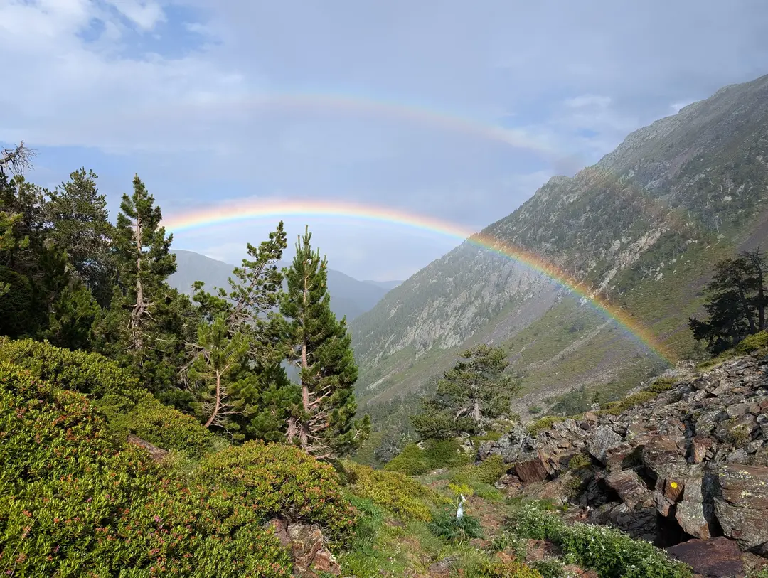
Rewarded with a double rainbow all to ourselves
Planning a Trip? - Some Practicalities
GPX Route
This GPX route was created after our ascent (as is reflected on the 3D route map). This removes the trail of us getting lost at the start but keeps the round trip route via the summit as described. Though the route to the summit follows a good path, mountain conditions can change, so treat this as a rough guide rather than a precise plan. Always prepare carefully and follow local safety guidance.
Getting There
Map of start point above - click "Open in Maps " to open Google/Apple Maps and get directions
There is plenty of parking in Arinsal, just drive to the head of the valley, towards the start of the trail. There is a man-made dike with tunnels at the end of the valley, with parking both in front of these at a hostel and parking after the tunnels in the official "Parc Natural del Comapedrosa" car park. Both are free.
Terrain
Up to the refuge, there is a well-maintained and clear trail (besides us getting a bit lost at the start). After the refuge, the trail becomes visibly less well trodden but is still clear enough, with regular markers (markers start as red and white and mostly switch to yellow dots/flags after the refuge). The final ascent to the summit involves some scrambling and/or a scree slope, depending on which way you go. We wore hiking shoes and largely found these to be fine, though some may prefer some more ankle support for the rockier sections. We also saw lots of trail runners though, which goes to highlight that it's all personal preference.
In July, there was still a patch of permanent snow between the two tarns, though we were able to skirt around this. Even if you had to cross this, I don't think it would cause any problems.
When to Climb
Arinsal is a ski resort in the winter, so the winter months unsurprisingly mean lots of snow on the mountain, which can hang around well into May and June depending on the conditions in a given year. The best times to climb would be the summer months and autumn. Outside of this time, you are potentially looking at ski mountaineering.
Refuge
Roughly halfway along the route, at 2,260m, there is a refuge - Refugi del Comapedrosa. This is a couple of minutes' detour from the main path, but it is well worth the lost time. Regular helicopter deliveries supply the refuge with drinks and snacks, which can be purchased (they accept card, though take cash just in case). There's something about a chilled drink on a hot walk that hits different. Lots of people just hike up to the refuge and back, though we did not find it particularly busy and were able to find seats outside on both the ascent and descent.
You can also stay overnight here, though I would imagine you have to book well in advance. This is not required to ascend Comapedrosa, but it would be an idyllic location to stay in if you're looking to extend the adventure.
Thunderstorms
Though not as bad as the Alps, the Pyrenees do experience frequent thunderstorms on summer afternoons. This means you generally want to head out early if you have a long day ahead on high ground. (We clearly didn't take our own advice.)
Flora
As in our Casamanya post, Andorra is home to one of Europe's most deadly plants - Monkshood. We did not see as much on this walk, but it is still worth being aware of. Basically, don't touch random flowers - and definitely don't eat any!
View near the summit with a definite weather front coming in, rain in the distance
Related Posts
Toubkal (4,167m) - Route Guide & GPX | Climbing Morocco's Highest Peak in Winter
Last updated: April 2026 The Atlas Mountains stretch across North Africa, forming a natural barrier between the Sahara Desert and the Mediterranean. The range tops out in the High Atlas at Mount Toubkal...
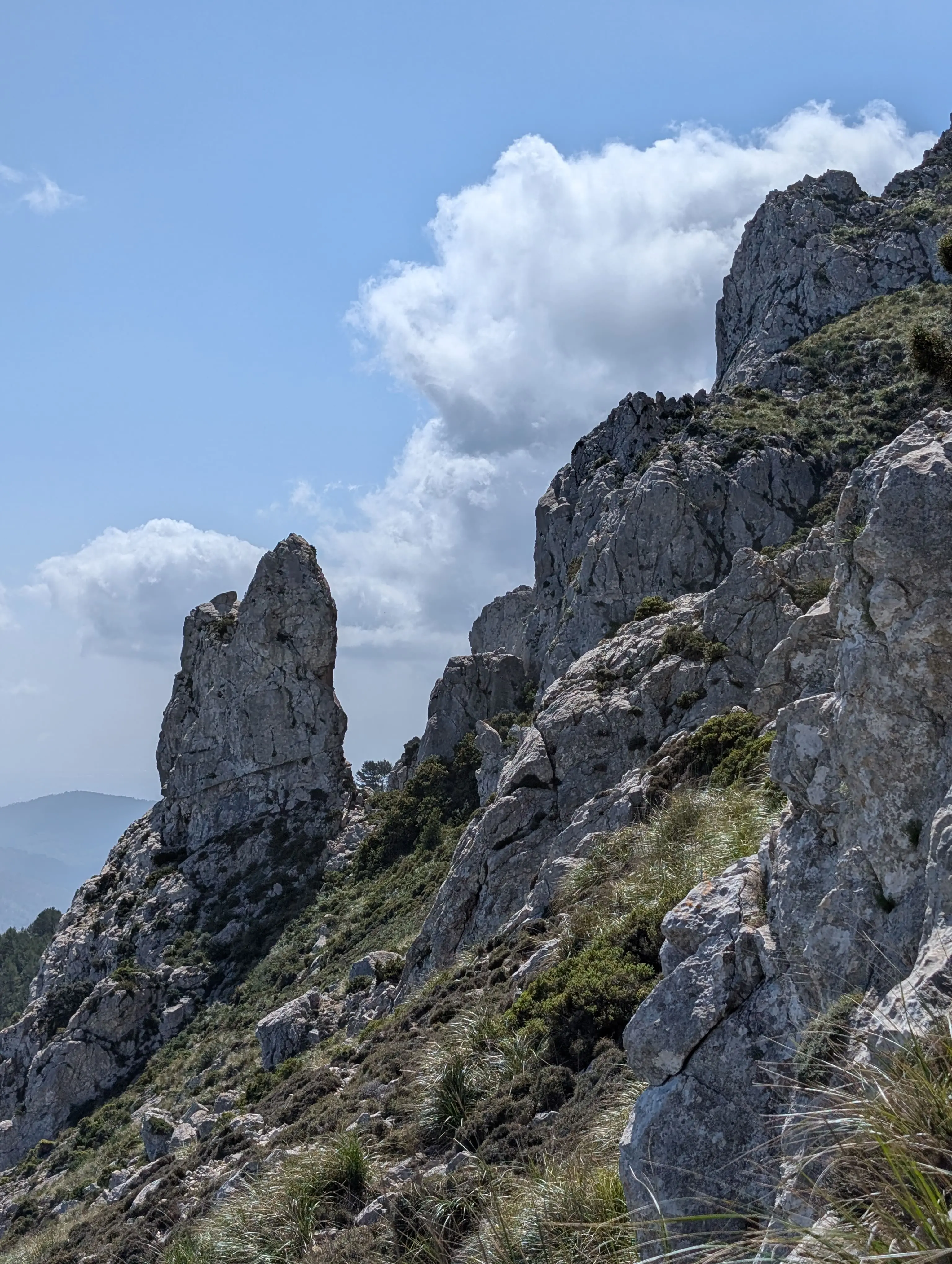
Puig de Galatzó (1,027m) - Route Guide & GPX | Climbing the “Matterhorn of Mallorca”
Last updated: April 2026 Mallorca was somewhere I’d always wanted to visit, but it wasn’t for the mountains; it was for the crystal-clear blue waters and some much-needed sun. To be blunt, I didn’t...
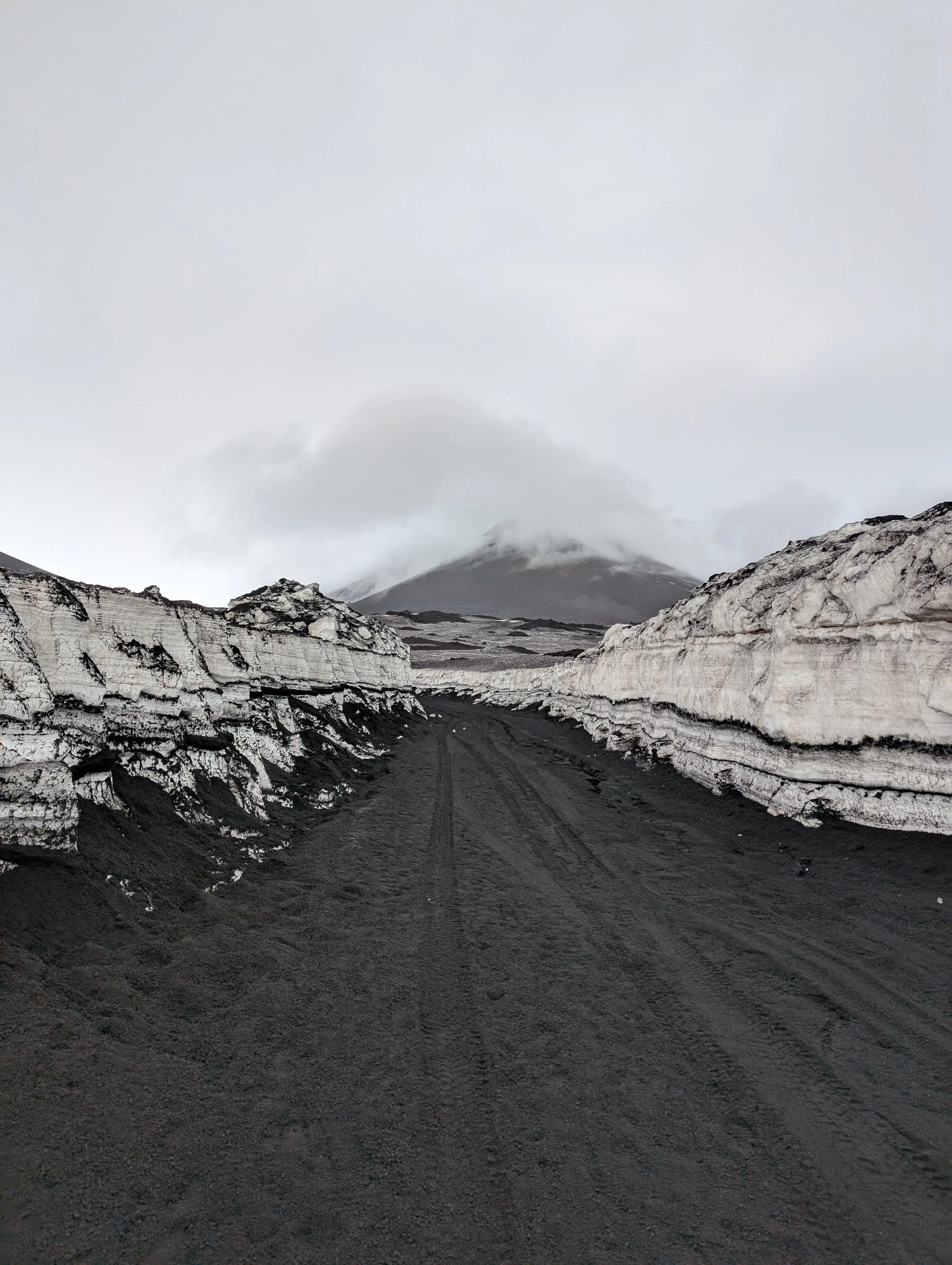
Mount Etna (~3,350m) - Route Guide & GPX | Climbing Europe's Most Active Volcano in Winter
Last updated: April 2026 Rising from the Mediterranean, Mount Etna stands as the highest volcano in Europe, the highest mountain in southern Italy and one of the world’s most active volcanoes. What...