- Published on
Casamanya (2,740m) - Route Guide & GPX | Andorra's Family Friendly Mountain
- Author
-
-
- Name
- Posts
- Posts
-
Last updated: April 2026
Nestled in the heart of Andorra, a mountainous European microstate, Casamanya stands as an unassuming "hill looking" mountain. At 2,740m, it would tower over any peak in the UK, but here it appears as a friendly grass-covered hill amongst the country's highest peaks.
This is frequently quoted as one of Andorra's most popular mountains, but on this beautiful July afternoon, we were blessed to have the peak to ourselves.
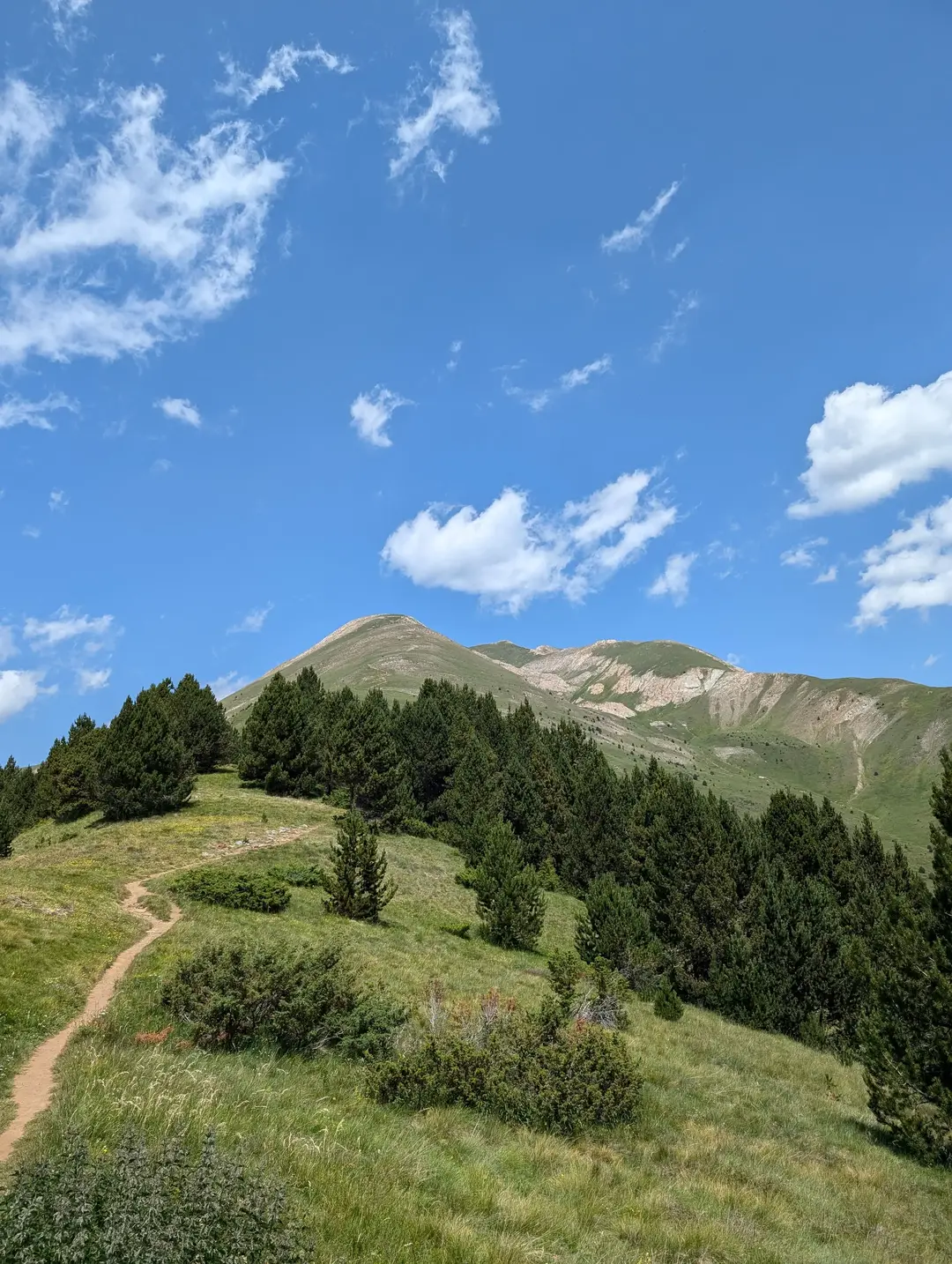
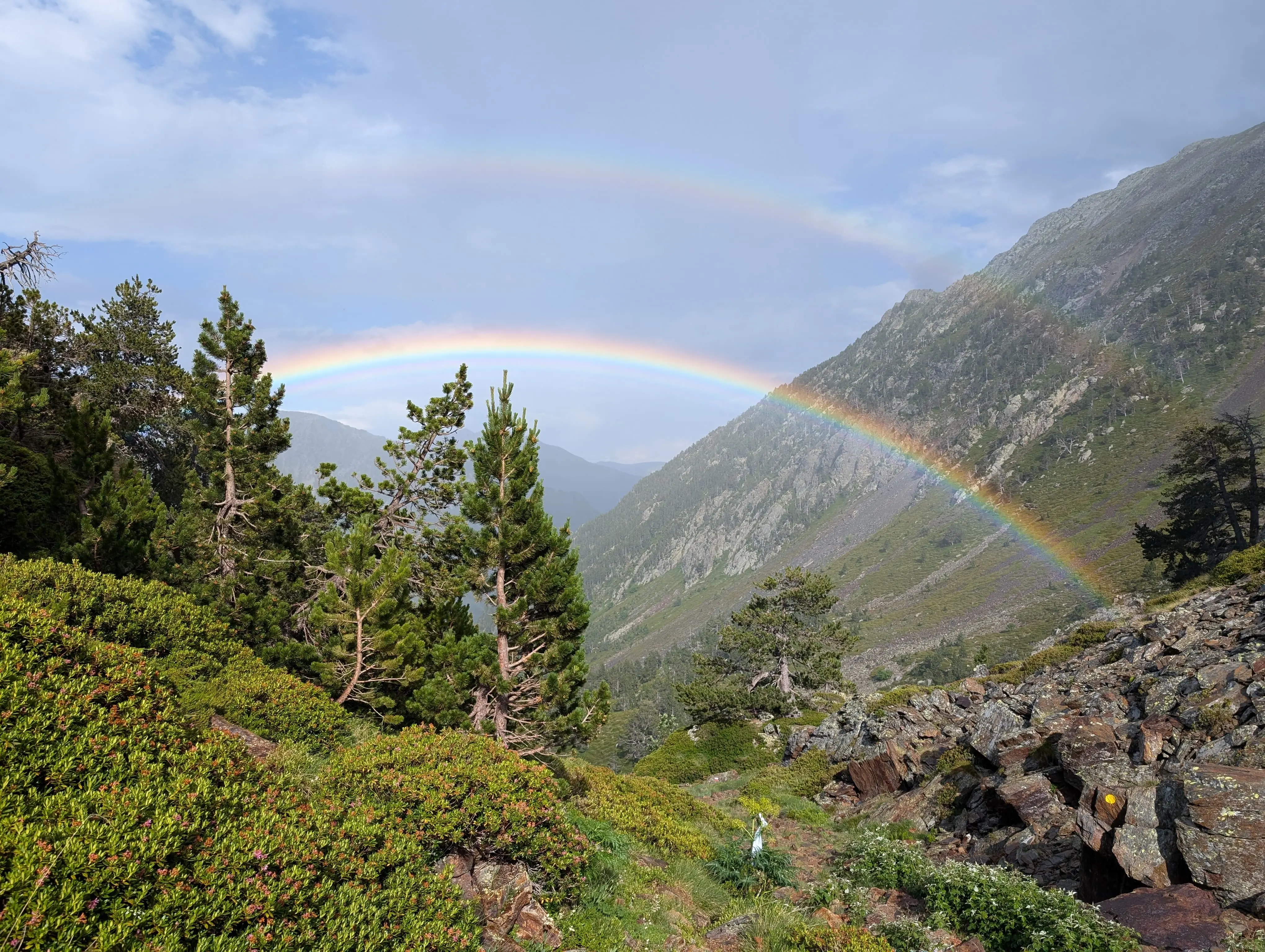
Casamanya above the thinning treeline
The hike to Casamanya's proud summit involves no more than a walk, which, though steep towards the end, presents no technical difficulty. Casamanya can easily be enjoyed in half a day, which makes it perfect for a sunrise/sunset walk. (Our original plan was for a sunset walk on the evening we arrived in Andorra, though my stomach had other ideas - the less said about that, the better!).
Regardless, whichever time of day you choose to climb Casamanya, the summit offers breathtaking views across the majority of Andorra and out over the surrounding Pyrenees. This would be an excellent route both for getting into climbing mountains and for experienced mountaineers looking for a more laid-back day. Saying this, 700+m of elevation is not trivial, so don't expect a literal walk in the park.
Casamanya Route Guide
Overall rating: ★★★★☆
Difficulty: ★★☆☆☆ - No scrambling, easy route to follow, not too long
Start point: Coll d'Ordino
Distance: 7km
Elevation: 740m
Time: Approx. 4 hours
Gear needed: Standard hiking gear
Need to know: Watch out for the poisonous flowers
The Ascent
Our route started from Coll d’Ordino, where there was a lay-by on the side of the mountain pass. Even from here, the view was stunning. To get here, we drove up from Ordino, which had already given a good glimpse of Casamanya and our route, which follows the grassy ridge all the way to the summit.
Leaving the lay-by, the route was clearly marked, we crossed the road and headed into the trees. Just off the road, we passed a sign warning of toxic plants. Andorra is home to one of Europe’s most poisonous plants – Monkshood, of which there is a fair bit along this route. As long as you don’t eat any, you’ll be fine (see “practicalities” below). I spent a fair bit of the walk needlessly paranoid about accidentally touching these - a bit more research beforehand would have eased this concern.
The first section of the route gently made its way through a pine forest, which obscured much of the view, providing only brief glimpses of the open mountains above. However, the gentle initial gradient was a welcome warm-up.
Soon enough, though, the trees thinned out and the smell of pine was replaced by the heat of the sun. We set out quite late in the day, around lunchtime, so at this point, we were hiking in the midday heat. This was less than ideal (and perhaps why we had the mountain to ourselves), but with lots of water and a laid-back pace, we were prepared plenty.
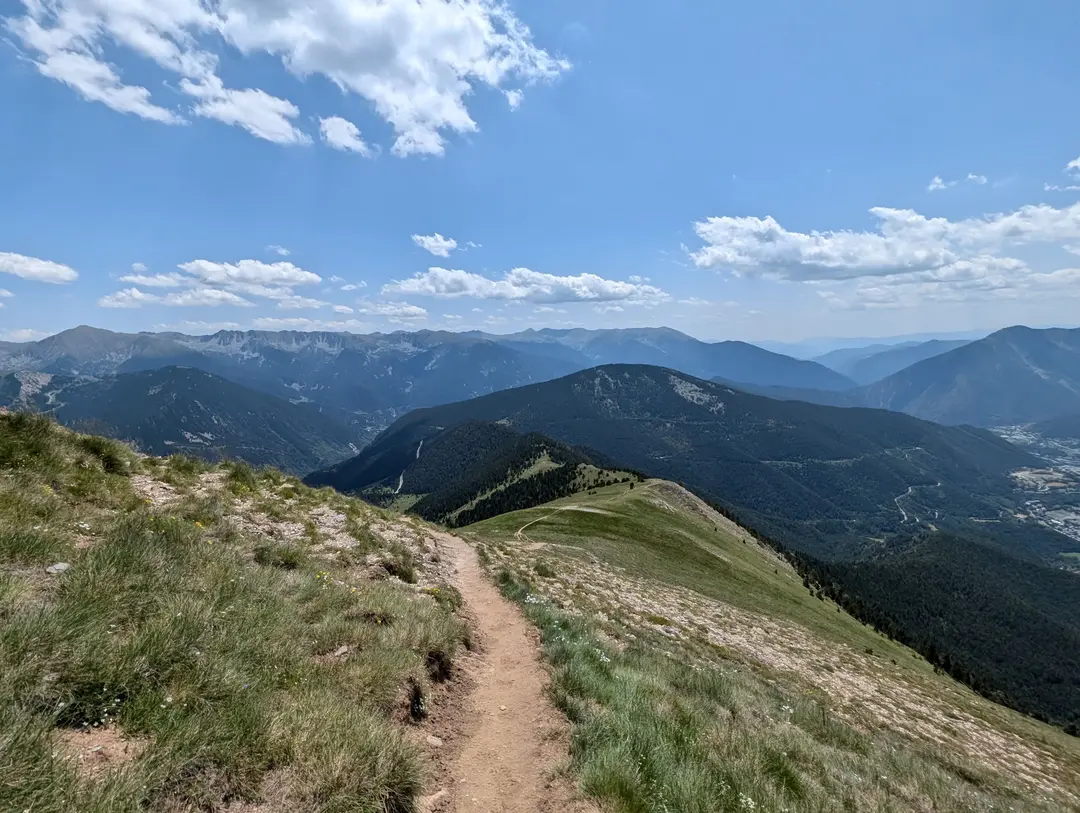
Looking back down Casamanya's grassy ridge
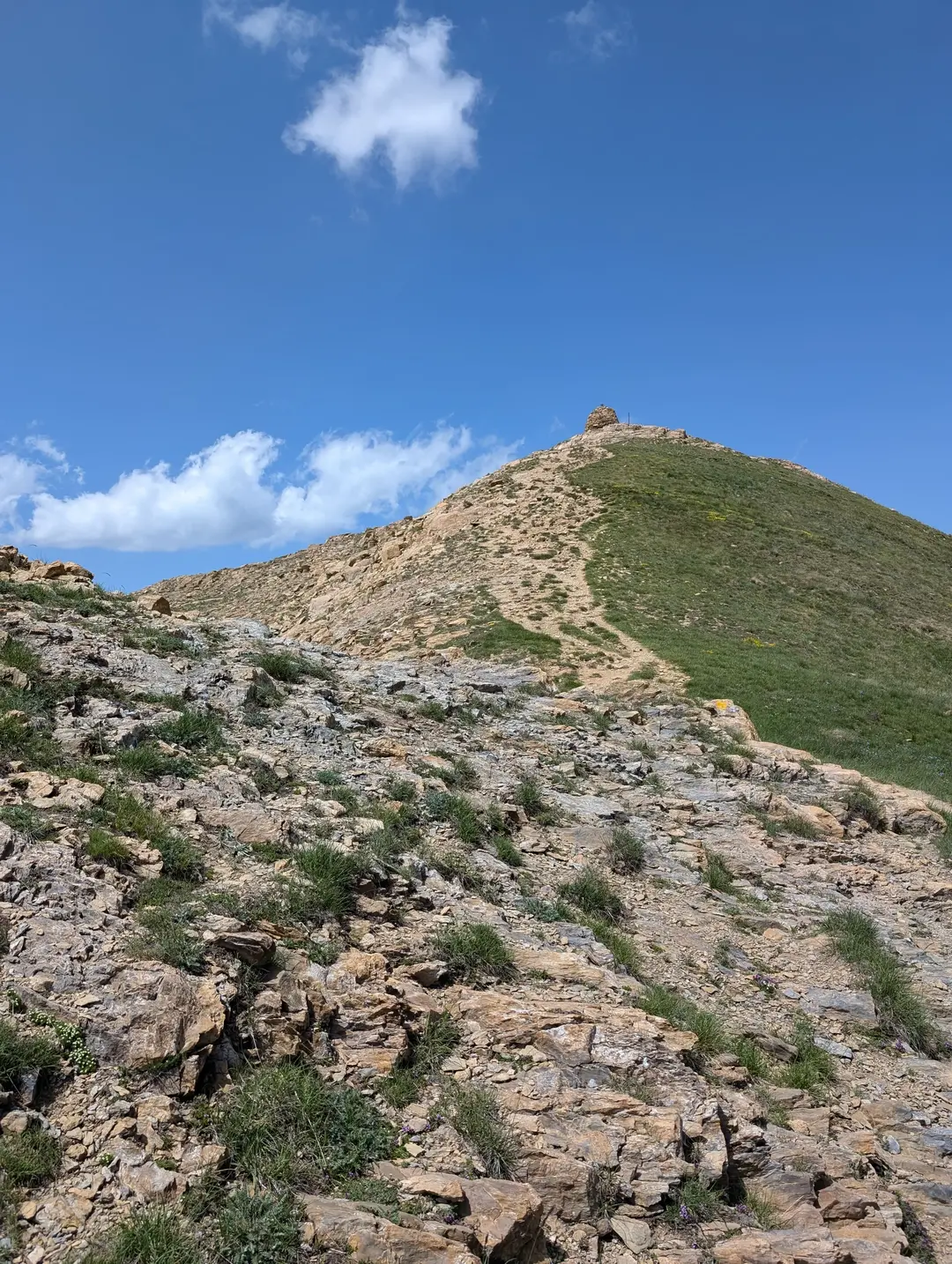
The final few metres of ascent, with the summit now clearly visible
The route continued up the ridge; route-finding was simple – just carry on heading up. Alpine flowers line the path, and there is a definite feeling that you are in “Heidi country”. The ridge itself has the appearance of a bumpy, undulating hillside, which obscured the true summit until we were practically there. There were several times we swore that “this is the one”, only to be greeted with more mountain over the crest.
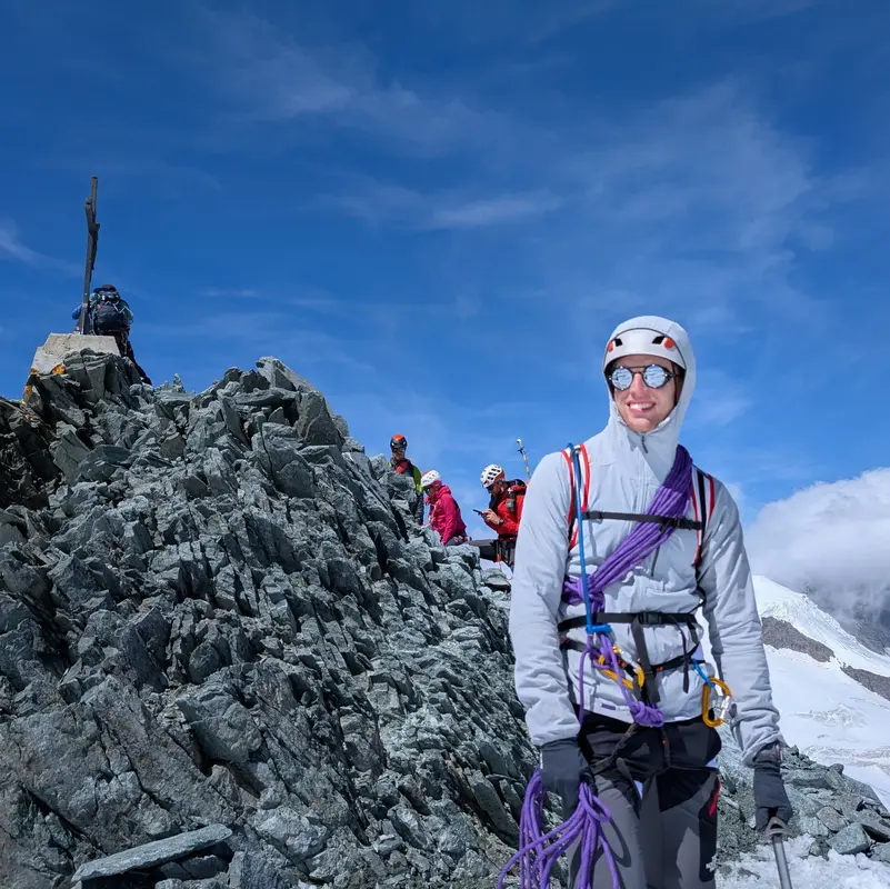
Eventually, though, the summit was reached, sporting a large rocky cairn and a fancy metal sign stating the name and height of this “little” mountain. Nestled within the cairn, in a plastic zip-lock bag, was a visitor book and pen, signed by everyone who had reached the summit. This sums up the friendly vibe of the mountain, and we enjoyed flicking through the messages left by people from all over the world. We obliged, signed the book, and slipped it back where we found it, ready for the next set of summiteers. Views out over the Pyrenees were stunning, and we spent a fair bit of time trying (to no avail) to work out which was Comapedrosa, Andorra’s highest peak and our objective for the following day.
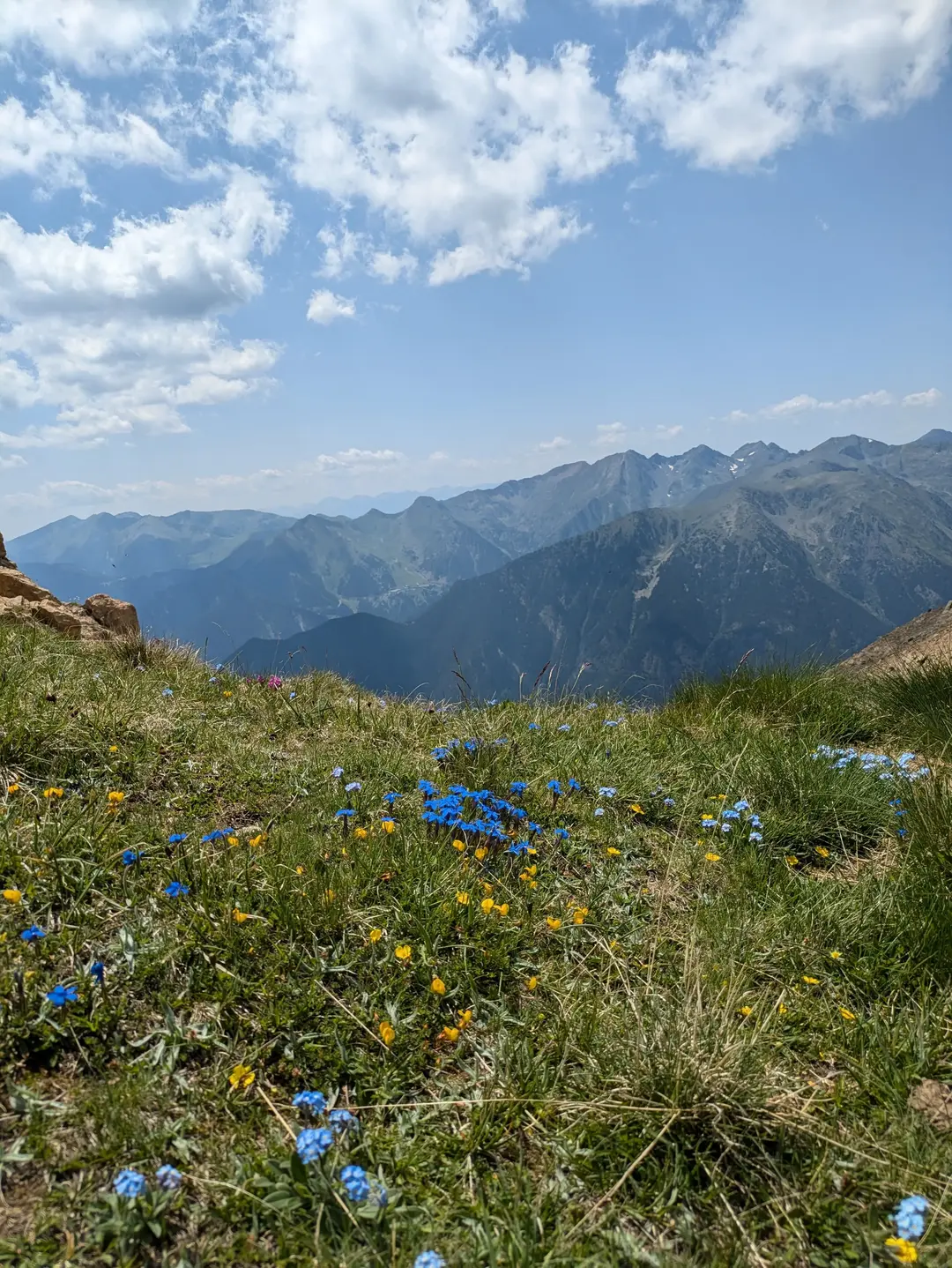
Some of the many wildflowers along the route - just don't eat them!
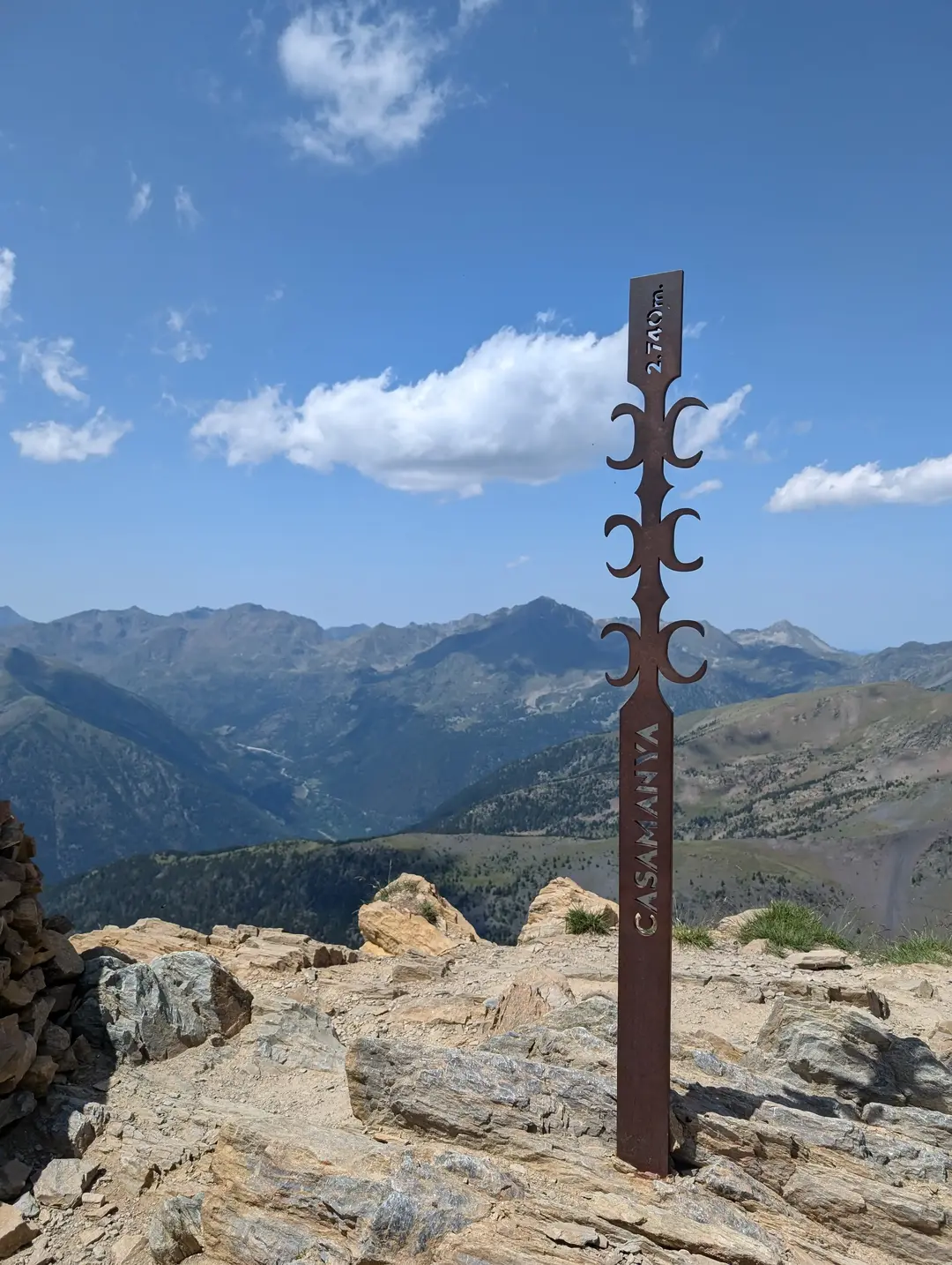
Metal marker on the summit - no room for confusion
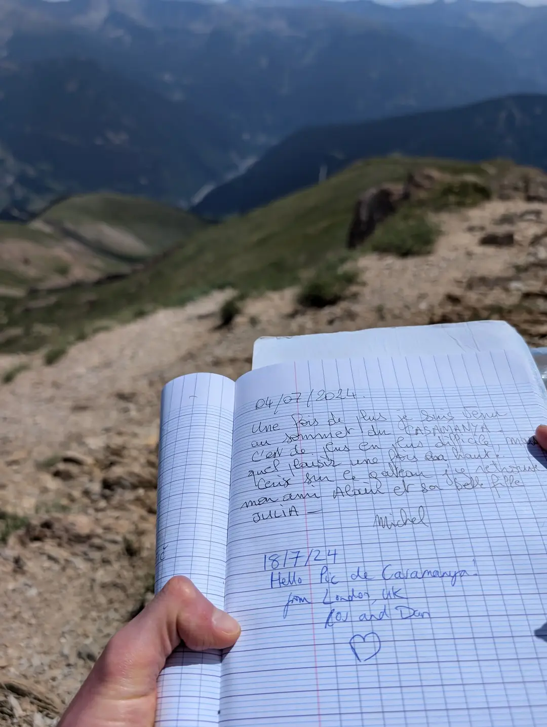
Obligatory signing of the summit book
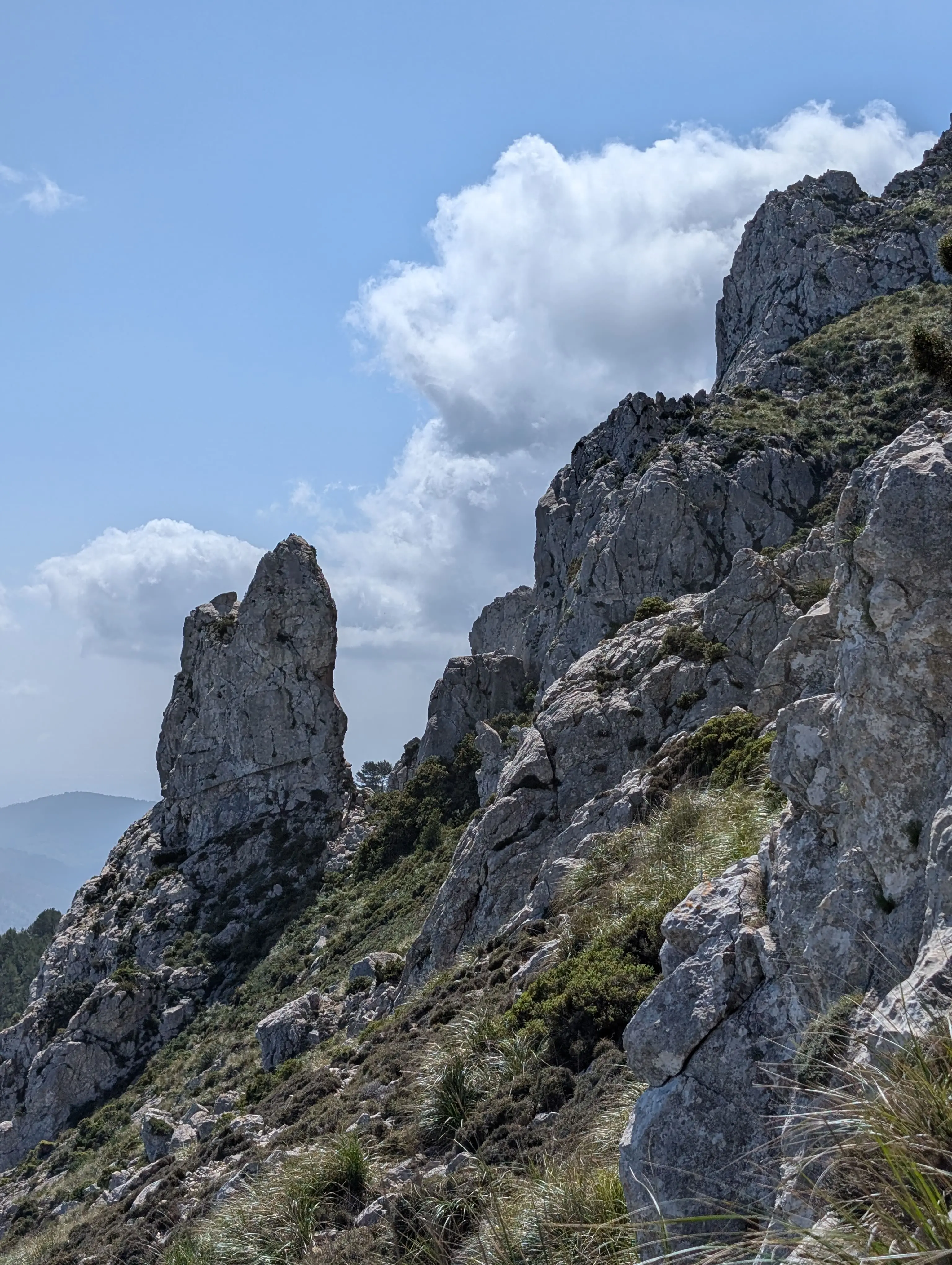
The elephant in the room is that this is not really the true summit of Casamanya – this is the west summit, with the adjacent north summit actually being about 10m higher. To reach the north summit, a short descent into the col is needed, followed by a steep ascent back up the other side. We did not do this – we were hungry at this point as we hadn’t eaten (or packed) lunch, so we were keen to get back down. The route is apparently not scrambly, but the terrain does look more serious, with the grassy slopes of the south face breaking out into the rocky north face. I can’t imagine the views from the north summit are much different to the west, but this is worth noting for the purists.
After a good 10 minutes on the summit, we turned around and headed back down the grassy ridge, into the trees and back to the car. All in all, the route took less than 4 hours and was a perfect afternoon adventure.
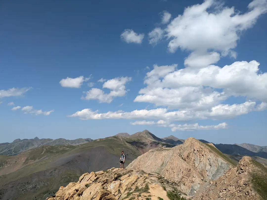
Exploring the west summit, with the north summit visible in the middleground, right of centre
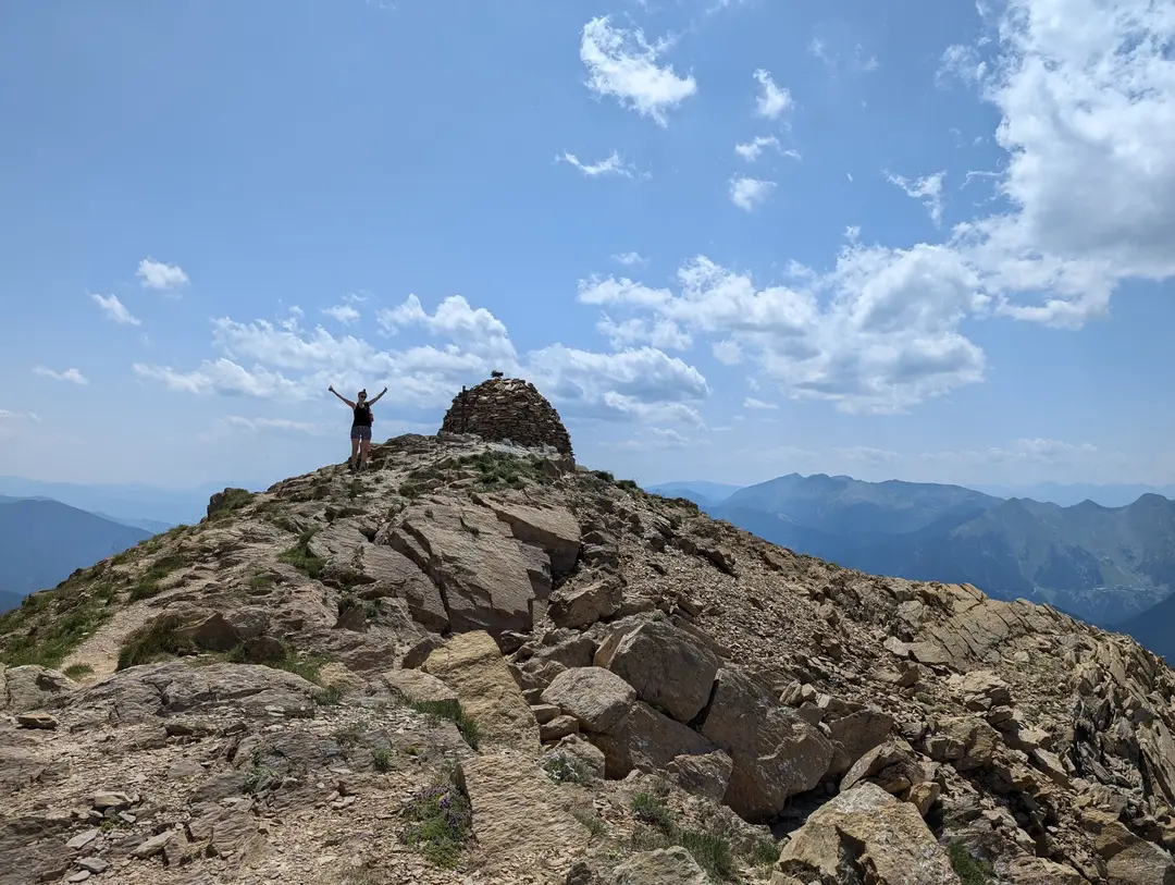
On the summit!
Planning a Trip? - Some Practicalities
GPX Route
This GPX route was created after our ascent (as is reflected on the 3D route map). Though the route to the summit follows a good path, mountain conditions can change, so treat this as a rough guide rather than a precise plan. Always prepare carefully and follow local safety guidance.
Getting There
Map of start point above - click "Open in Maps " to open Google/Apple Maps and get directions
We parked up at the lay-by at Coll d'Ordino. There aren't a great deal of spaces here, but we had no problem finding a spot, even on a beautiful summer's day in July. I imagine the story might be different on the weekend, given that this is supposed to be one of the most popular walks in Andorra.
Terrain
The terrain underfoot is pretty tame, a standard hiking route, really and no scrambling. You could probably get away with trainers, but I wouldn't recommend it - we wore approach shoes.
When to Climb
The summer and autumn months are best to climb. Given its altitude, despite the relatively tame nature of the ascent, Casamanya can be covered in a lot of snow and ice in winter and spring. An ascent in these months would probably involve skiing.
Poisonous Flowers
At the start of the walk, there is a warning sign for toxic plants, as there are lots of Monkshood along the route. These are one of Europe's most toxic plants, with the compounds historically being used as poison. The flowers can be a variety of colours, generally purple, blue or white, but the whole plant is poisonous. As long as you do not touch (or eat) them, you will be fine, but any children or dogs on the trail should probably be kept under close eye to be safe.
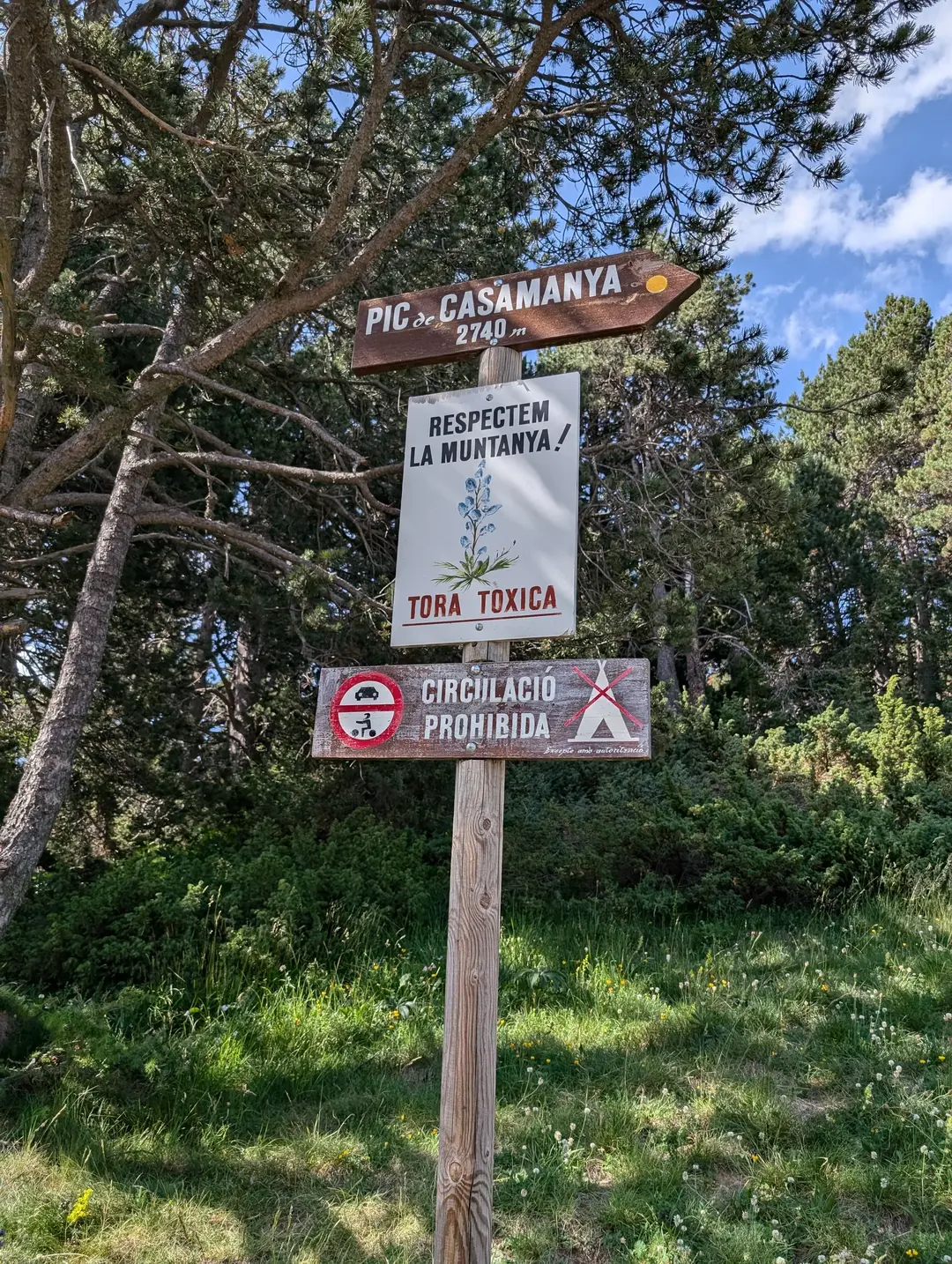
My Catalan isn't great, but that's pretty clear!
Related Trips
Puig de Galatzó (1,027m) - Route Guide & GPX | Climbing the “Matterhorn of Mallorca”
Last updated: April 2026 Mallorca was somewhere I’d always wanted to visit, but it wasn’t for the mountains; it was for the crystal-clear blue waters and some much-needed sun. To be blunt, I didn’t...
Mount Etna (~3,350m) - Route Guide & GPX | Climbing Europe's Most Active Volcano in Winter
Last updated: April 2026 Rising from the Mediterranean, Mount Etna stands as the highest volcano in Europe, the highest mountain in southern Italy and one of the world’s most active volcanoes. What...
Comapedrosa (2,943m) - Route Guide & GPX | Andorra's Highest Mountain
Last updated: April 2026 Whilst the Alps get most of the attention in the European mountain scene, there’s an equally beautiful and dramatic range on the other side of France. The Pyrenees form the...