- Published on
Mount Teide (3,718m) - Route Guide & GPX | Sunrise from Spain's Highest Mountain
- Author
-
-
- Name
- Posts
- Posts
-
Last updated: April 2026
Pico del Teide, or Teide for short, rises magnificently out of the Atlantic Ocean on the island of Tenerife. At 3,718m, it is probably one of the highest peaks in Europe that can be climbed with no real technical difficulty. It also happens to be the highest mountain in Spain (though subject to debate). On our second trip to the Canary Islands, an excuse to get some winter sun, we decided to get up super early to try to beat the sun to the summit.
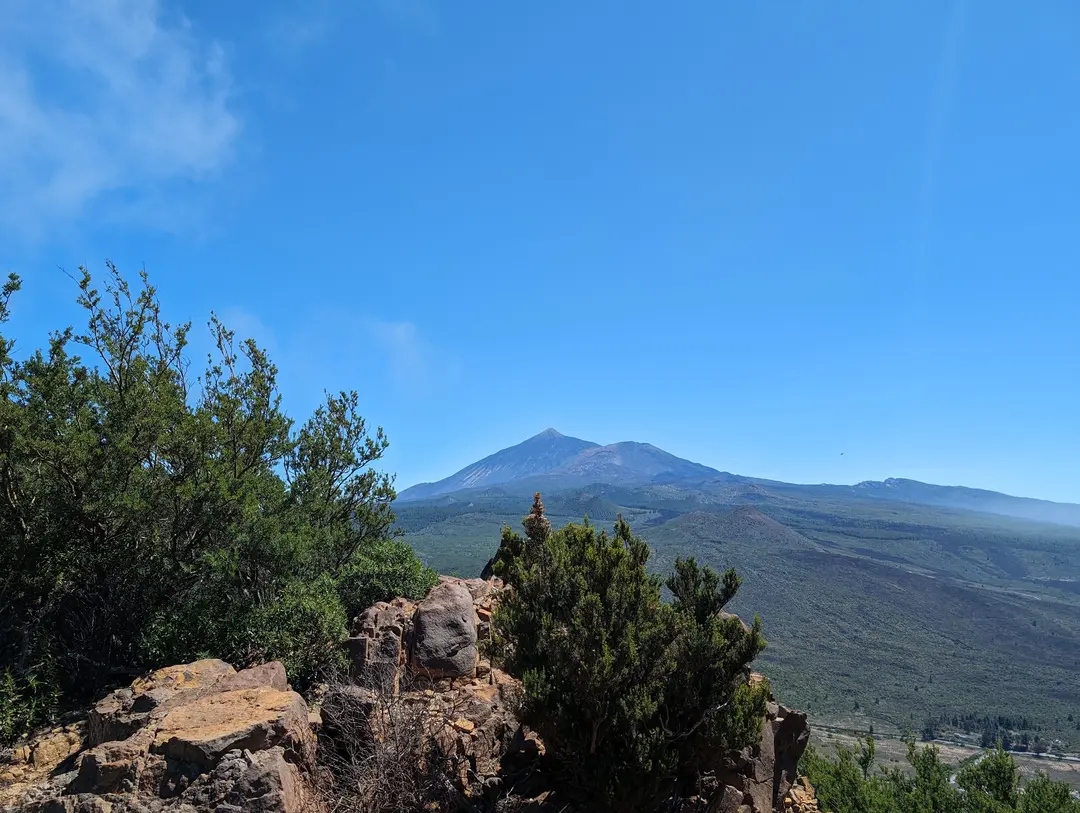
Teide seen from a later hike in the Masca area
The Canary Islands are, unfortunately, probably most well known for being a package holiday destination where Brits can fly away for cheap to spend their week drinking excessive amounts of alcohol and topping up their bright red "tans". This reputation has partly led to several protests on the islands for the government to step in and prevent overtourism. However, look beyond the tourist hotspots of the south of the Island, and there are a multitude of great adventures to be had that do not involve copious amounts of alcohol.
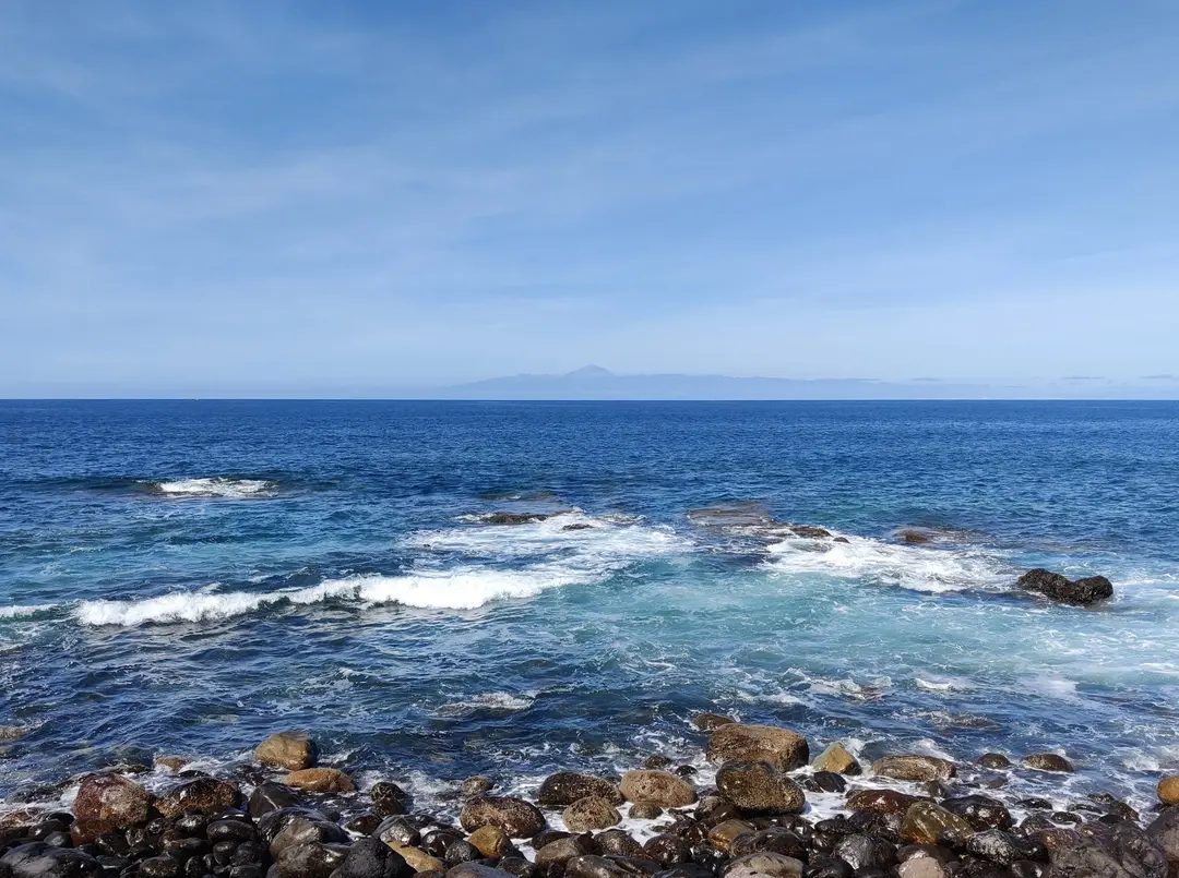
One of these adventures is an ascent of Teide. Rising to 3,718m at the very centre of the island, it is visible from pretty much wherever you are. This elevation makes it the highest mountain (well, volcano) in Spain and the third-highest volcano in the world, when measured from the ocean floor. A fact that may slip past those sticking to tourist hotspots is that Teide is actually an active volcano, though it last erupted in 1909.
Teide Route Guide
Overall rating: ★★★★★
Difficulty: ★★★☆☆ - No technical difficulty but steep at times (I wasn't the most fit when we climbed this, which might have skewed my rating - Ros didn't struggle)
Start point: Sendero de Montana Blanca
Distance: 9.5km (one way)
Elevation: 1,350m
Time: Approx. 5 hours
Gear Needed: Standard hiking gear
Restrictions: Permit needed
High Point Controversy
Okay, that title is potentially overdramatic. Teide's height makes it the highest mountain in Spain's overseas territories. It is partially up for debate as to whether this qualifies it as the highest point in Spain. The highest point on mainland Spain is Mulhacén, 3,479m in the Sierra Nevada mountains.
Though there is no argument that the Canaries are part of Spain politically (as far as I am aware), geographically, they are closer to Africa than Europe. If you want to fully go down the rabbit hole of including overseas territories, then Mount Paget, 2,935m, on South Georgia and the Sandwich Islands, would be the highest mountain in the UK. I think it is fair to say that no one is claiming that. Ultimately, most people think of the Canaries as part of Spain, which has led to Teide being widely seen as Spain's highest mountain.
The Ascent
At 12 am, the alarm rang - a solid 3 hours of sleep. We had a light breakfast consisting of a banana and a coffee before jumping in the car (an exaggeration given the 3 hours of sleep) to make the drive to the base of the walk. The sky was cloudy, and hopes were not particularly high that we would be greeted with much of a view on the walk.
The drive from the steep cobbled streets of La Orotava, up onto the windy roads into Teide National Park soon took us up above the clouds though – 2,000m of elevation will do that. This revealed a beautifully clear sky, with only the faint glow of the main towns on the horizon by the time we parked up, with hundreds of stars clearly visible. The Teide National Park is home to an observatory, and it is clear to see why.
We arrived at about 1.30 am, and by this time, the main car park at Sendero de Montana Blanca was already full of cars. We carried on driving for a few minutes and pulled up in the first layby. This added a bit of distance along the road to the start of the walk, but we were glad to have found a spot.
With head torches on in the early hours, the first few kilometres were fairly gentle, along a clear gravel path, which was a nice way to get into the walk given the early start. We passed, and were passed by, a few people along the way, and could always see headtorches ahead and behind us, which was enough to be comforting that we were not completely lost, but not so much that it felt like some sort of nocturnal conga line up the mountain.
Before long, the path steepened as it zig-zagged its way around Montana Blanca and up the slope of Teide, passing by the Teide Eggs – huge rocks on the otherwise featureless slopes of the volcano that were spat out during previous eruptions. With a clear sky above, we were often able to see the outline of the volcano above us, definitely a bit of fake-summit trickery going on, but motivating nonetheless. As we gained elevation, it became noticeably colder and windier, which seems obvious but was a bit of a shock given the previous day we had been hiking in temperatures approaching 30C. A puffer jacket and a hard shell are not items most visitors to Tenerife bring, but they were definitely coming in handy for us now.
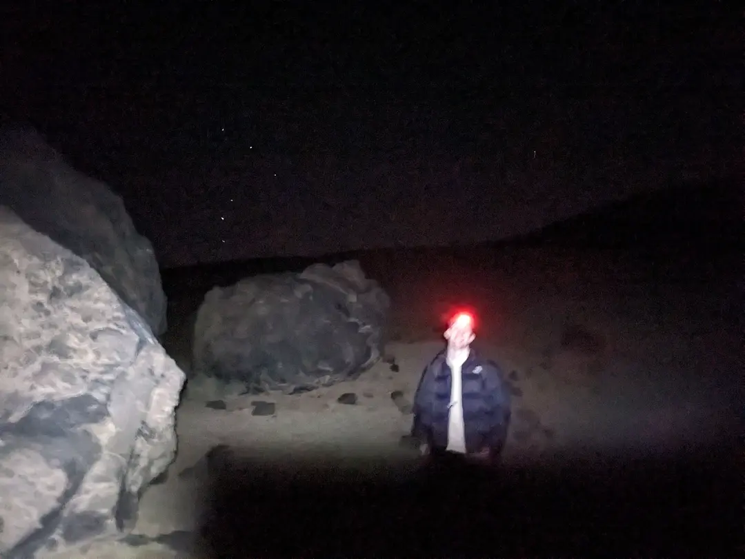
A break by the Teide Eggs (great name) - excuse the rubbish low-light picture quality
Within about 3 hours of starting, the refuge became visible on the path ahead, illuminated by someone’s exceedingly bright flashlight. This was closed when we visited, a victim of the COVID-19 pandemic. A coffee would have been nice, but we made do with a rest in the porch by the barred doors and offered Haribos to the growing number of hikers also taking shelter. This was a welcome break from the cold and wind and allowed us to kill half an hour or so as we realised we were on track to get to the summit in the dark.
Semi-rejuvenated and on a mild sugar rush, we left the refuge and continued the ascent. From this point, the elevation began to become noticeable, with every step feeling just that bit harder. Nothing too bad at this point, but definitely noticeable. This ascent only lasted for a few hundred metres before the path levelled out and began traversing the mountain towards the cable car station. The infrastructure here was noticeable - up to this point, besides the refuge, the route was a simple, clear path. However, up here there was a well-engineered walkway and even bins – it was a good indication that we were approaching the cable car station, if a bit jarring.
By the cable car station, there is a metal gate that you pass through where an official is supposed to check your permit (see practicalities below). As expected, no one was here first thing, though I had bought our passports just in case and had been compulsively checking my pockets approximately every 5 minutes as a result. By now, there was a light glow on the horizon, which added a sense of urgency to the 200m of ascent that followed; we wanted to be on the top for sunrise, not halfway up! This was probably the steepest section of the whole walk, and we had to use our hands a few times, but no serious scrambling to note. This rushed final ascent did not do wonders for the headache I had now developed.
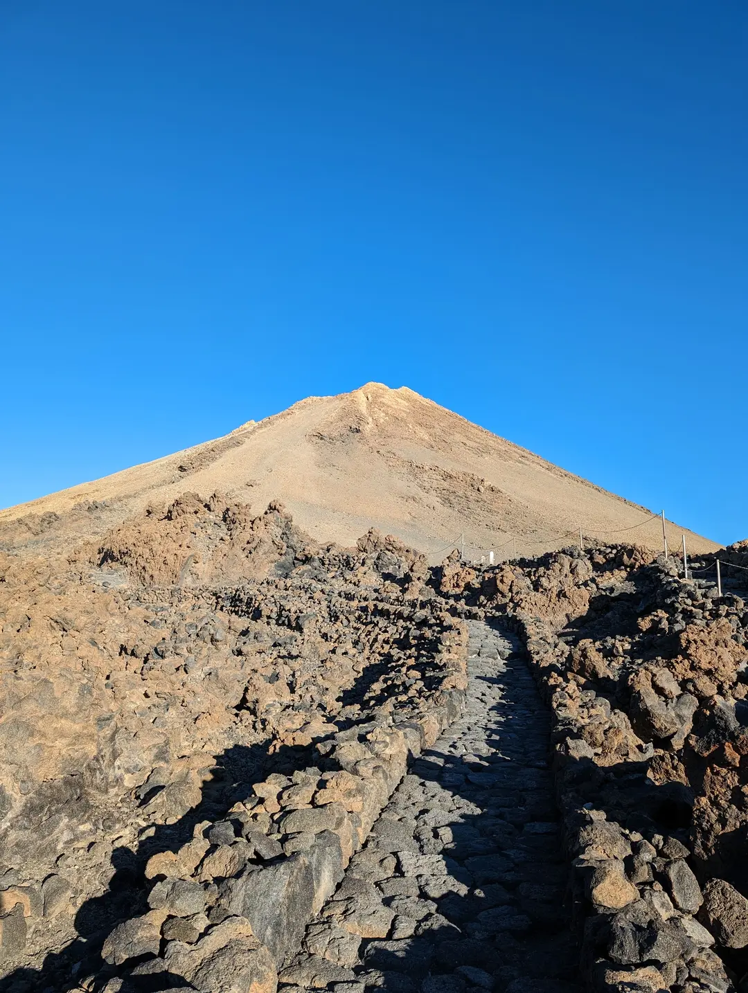
The summit cone, seen here on the descent, from the gate where a permit is required
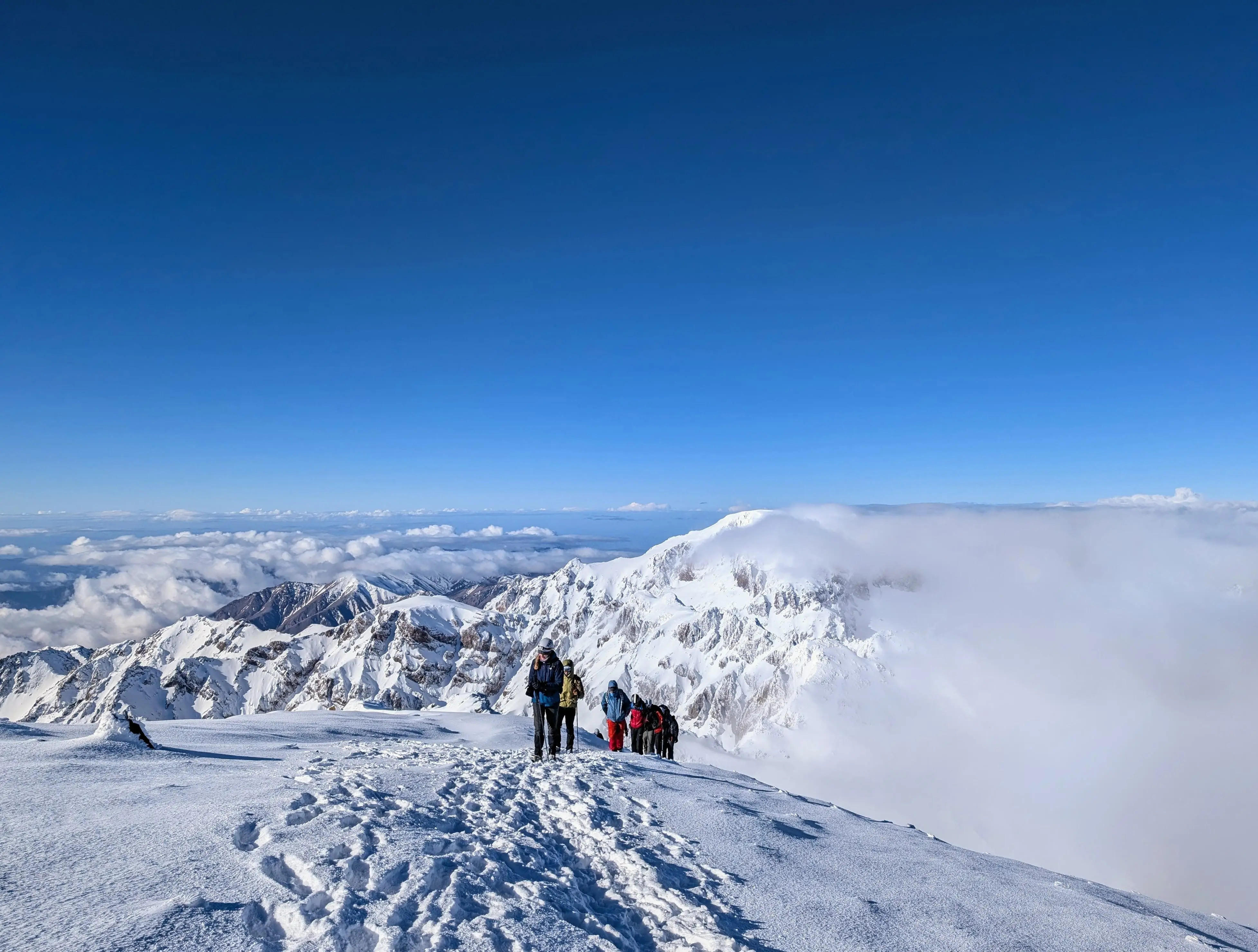
By 6.45 am, we had reached the summit, with the sky now turning a dark blue, but the sun still below the horizon. Any concerns about my headache were quickly forgotten as I made the most of the time to snap pictures of the view before the summit amassed more hikers over the next 15 minutes. This was a good distraction from the cold – we now both had hats and gloves on, which I thought was overkill to pack beforehand. What I failed to realise before the hike is that, given Teide is active, there are actually small sulphurous vents by the summit. This excited my inner geologist and made the outing feel just that bit more adventurous, which is one way of saying that the summit had a faint smell of egg.
Another thing that excited my inner geologist is that the walls of the Las Canadas Caldera were also visible below. I did not realise this at the time, but there is a theory that Teide once formed part of a much larger volcano which erupted and collapsed in on itself to form a large caldera. You can definitely get a sense of this from the summit, as you see the far walls of the caldera curve towards you from the south, it is not hard to imagine this as one large volcanic crater.
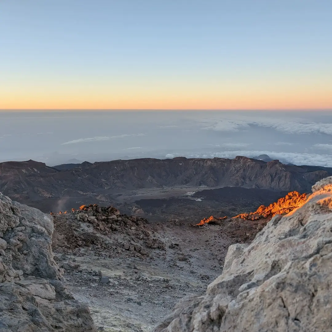
The Las Canadas Caldera from the summit
It would be a shame to walk down
Just after 7 am, the sun broke the horizon, illuminating the cloud well over a kilometre below us and turning the perfectly clear sky above a bright orange. The Teno and Anaga mountains that we had spent the rest of the holiday exploring seemed nothing more than small pebbles below amongst the sea of clouds.
Given Teide’s shape (almost as a child would draw a volcano), the mountain casts a perfect conical shadow out over the sea. This is apparently the longest shadow cast onto water in the world, an odd and admittedly specific claim. This was truly a magical experience and well worth the early start. It's a shame that most visitors to Tenerife will not see this, but I suppose it would not be as special or enjoyable with that many tourists!
We were in no rush to leave the summit, given that our getaway, the cable car, did not open until 9 am. However, before too long, the cold got the better of us, and we made a slow descent down to wait by the cable car station. This was not before one of the other hikers asked us about how to buy cable car tickets, exclaiming in a strong German(?) accent, “It would be a shame to walk down”. Quote of the trip.
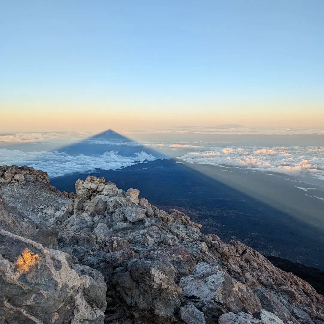
The mountain casting its shadow
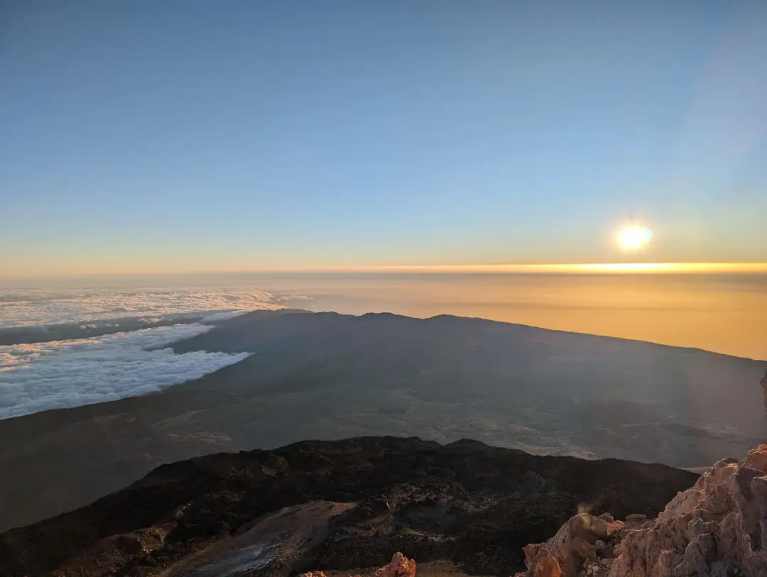
The sun peeking out from the sea
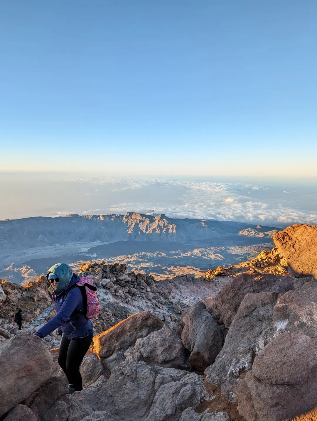
Starting the short descent back to the cable car
Planning a Trip? - Some Practicalities
GPX Route
This GPX route was created after our ascent (as is reflected on the 3D route map). Though the route to the summit follows a good path, mountain conditions can change, so treat this as a rough guide rather than a precise plan. Always prepare carefully and follow local safety guidance.
Getting There
Map of start point above - click "Open in Maps " to open Google/Apple Maps and get directions
The path starts from Sendero de Montana Blanca, which is a small car park. We gather that this is usually full - we climbed Teide in March and by 1.30 am this was already full. However, there are plenty of other small car parks/laybys along the road, so all is not lost. Regardless, early starts are best to avoid having to trudge for too long along the road first thing.
Cable Car
At around 3,550m, there is a cable car station. This runs from 9 am to 5 pm every day. We made use of the cable car on the descent, which most people seem to do. In strong winds or poor weather, the cable car does not run. You probably would not want to be on Teide in these conditions anyway, but you should feel fit enough to be able to make the descent on foot in case you need to. Check/book before you leave here.
When to Climb
Teide can theoretically be climbed year-round. Whilst Tenerife tends to have a mild winter climate, Teide's elevation means that it can see snow and ice in the winter months. Even without snow on the ground, it can be very cold at higher elevations - we were quite cold on the top even in March. As such, it is probably best not to plan a winter ascent unless you are prepared to take ice axes, crampons and walk back down (cable cars wouldn't be running if there is a lot of snow). Though you should have no issues in the peak of summer, plan ahead for very hot weather - early starts are probably best in that case.
Permits
To continue ascending past the cable car station, a permit is required. You will pass through a rusty metal gate - during the day, there are checks here for permits and passports/ID documents. Permits through the day are issued in 3-hour time slots starting at 9 am and ending at 5 pm. These are available for free from the National Park website, though they usually "sell out" months in advance. The website is very slow, so be patient.
Those of you paying attention will notice that those times correlate with the cable car schedule - presumably because someone needs to be at the gate to check permits. The gate is not locked at night, however, and separate permits are available for pre-9 am and post-5 pm ascents. We obtained the former - these do not seem to sell out as fast as the daytime tickets.
There are definitely people who take advantage of the fact that no one is checking permits before 9 am and ascend without one. If only for the peace of mind, we would advise against this.
Terrain
The path itself is easy to follow and well-marked. Solid footwear would be recommended - we wore approach shoes, but did see people in trainers at the top (would not advise this). There are a few small sections of super light scrambling, but the route presents no real technical difficulty.
Refuge
At around 3,200m, there is a small refuge. This was closed when we visited and has been since the pandemic. If open, a climb up the evening before and then a less early start the next day could be nice. At the moment, it seems like this is going to be closed for the foreseeable future. Check before you leave here.
Teide can be seen on the horizon from the other Canaries - seen here over 90km away in Gran Canaria
Altitude
Teide's elevation puts it in the realm of "very high altitude". That conjures up images of horrific altitude sickness on peaks like Everest. Teide is not in the same town, let alone ballpark, as these, but you may find the altitude does affect you.
I personally found this most evident past the refuge, where I noticed I got out of breath more easily and developed a mild headache. I felt like I was going to be sick later on in the day, which may have been linked to this. Factors like getting next to no sleep and not drinking enough probably exacerbated any effects I felt (if they were not the main causes).
Regardless, it is something to consider. You will likely be travelling from close to sea level at your accommodation to well over 3,500m within several hours. That is likely to have some effect.
Tips to make sure you are minimally affected include:
- Get sufficient sleep in the days leading up to your climb
- Do some more walks at reasonable altitudes before your climb to give your body the best chance to acclimatise. There are plenty of other walks in the Teide National Park which would provide great views of Teide.
- Eat plenty of carbs the day before your climb
- Drink plenty of fluids - especially if climbing on a summer's day, people go to Tenerife for a reason - it's hot!
- Make sure you apply sunscreen if climbing in the day (UV is stronger up high) and bring more warm layers than you think you need if climbing at night (gloves and a hat are not overkill).
Related Trips
Toubkal (4,167m) - Route Guide & GPX | Climbing Morocco's Highest Peak in Winter
Last updated: April 2026 The Atlas Mountains stretch across North Africa, forming a natural barrier between the Sahara Desert and the Mediterranean. The range tops out in the High Atlas at Mount Toubkal...
Puig de Galatzó (1,027m) - Route Guide & GPX | Climbing the “Matterhorn of Mallorca”
Last updated: April 2026 Mallorca was somewhere I’d always wanted to visit, but it wasn’t for the mountains; it was for the crystal-clear blue waters and some much-needed sun. To be blunt, I didn’t...
Mount Etna (~3,350m) - Route Guide & GPX | Climbing Europe's Most Active Volcano in Winter
Last updated: April 2026 Rising from the Mediterranean, Mount Etna stands as the highest volcano in Europe, the highest mountain in southern Italy and one of the world’s most active volcanoes. What...